Climbs 35
Rocktype Limestone
Altitude 1320m a.s.l
Faces all
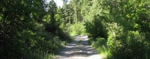
Typical view of 3.5 mile track to crag. Not suitable for all vehicles. © smollett
Crag features
Climbing is mainly located on the east side of a steep sided valley. There are a good variety of 1 - 2 pitch routes which are mainly bolted but additional protection is needed for some routes. The crags contain some good crack climbs as well as a lot of slabs. The limestone is particularly sharp in places and a brain over brawn approach pays off for some routes.
Approach notes
Mulkey Gulch is located between Missoula and Drummond. If approaching from Drummond take the Frontage road (old highway 12) West out of town. This road runs parallel to the I90. A right turn after 7.5 miles (signposted to Mulkey Gulch) leads onto a dirt track. Follow this over a cattle grid and up single track road for 3.5 miles turning left at a junction a couple of miles up (passing dry mulkey gulch). There are a couple of parking places but the best one to use is on the left just before the bottleneck area. The track is quite rough in places and has very few passing/turning places. A 4WD or car with reasonable ground clearance is recommended. The land is privately owned but the landowner is apparently friendly towards climbers and it is possible to camp discretely near the crag.
| There are no comments from visitors to this crag. |
Climbs at this crag
| Name | Grade | Stars | Type | Logs | Partner Ascents |
|---|
These climbs you have climbed by seconding or top-roping.
These climbs you have Dogged.
These climbs you Did not Finish.
Climbs are waiting to be checked by a crag moderator, and may not be accurate. Climbs can't be verified by a crag moderator, and they need more information to confirm it. Climbs are no longer climbable.
Moderators Updates to this page are checked by a UKC volunteer smollett