
This topic has been archived, and won't accept reply postings.
 UKClimbing and Rockfax Director Alan James makes the case for omitting specific route and rope lengths from guidebooks.
Back in 2009, when we published the France: Haute Provence Rockfax guide, we took the decision to remove route lengths from the descriptions of single pitch sport routes in our guidebooks. The reason for this is simply because we don't feel that it is possible to provide accurate route lengths and, when combined with other external factors, the provision of this information can lead to dangerous practice by some climbers.
Read more
20
11
In reply to UKC Articles:
There is another slight complication - in Kalymnos and other areas too presumably. In general the route lengths given in the current guide and sometimes written on the rock are on the generous side - but not always - occasionally they are underestimates - not helpful.
Chris
Post edited at 10:48
3
In reply to Chris Craggs:
Even if they're not underestimates, if people get used to being ok on "40 metre" routes with 70 metre ropes, they can be unpleasantly surprised when they're suddenly not quite so ok.
2
1
In reply to UKC Articles:
My initial reaction to this article was to suggest an alternative headline "We can't be arsed to do our job properly". Having written guidebooks, I know what a tedious pain in the buttocks it is getting the facts and figures right but, come on, that is the whole point of the guidebook, isn't it? And of all the facts in a sport guide I would argue the route length is, in terms of safety at least, probably the most crucial. I want to pick a route I know my rope can cope with. I should not have to guess the length. Without that info an awful lot can go wrong - not just carelessly lowering off the end of the rope but perhaps finding myself 10ft up and 20ft out from the rock with the stopper knot jammed up against the belay device. Once I have an accurate length - much easier to measure on sport with fixed runners than trad where I might wander off line in search of pro - I can make my own judgements
The argument that it is too hard to measure route lengths does not wash. Measure and mark your own rope and then check length at the same time as you climb it to check the grade. You do climb it to check grade, don't you? Or are you saying you don't actually climb them but either 'grade from the ground' or fillet other guides and so cannot measure them? Either way it's a bit rich to accuse rope manufacturers of being 'lazy' for not cutting their ropes to accurate lengths if you can't be bothered to measure pitches.
Also I don't buy the reasons/excuses about not being able to predict where belayers will stand or whether climbers will clip off-route runners etc or how long an individual climber's rope may actually be. The job of the guidebook writer is to give accurate information. That is all they can do. after that it is up to us as climbers to use that information safely and sensibly.
174
23
In reply to UKC Articles:
for single pitch stuff like this the only thing needed is the range of route heights for a crag, e.g. routs between 15 - 35m; also shown in the crag overview. The rest is nice-to-haves if the writer is happy with the veracity of the info.
I need to be able to quickly review and discard the crags that aren't appropriate, or have little to offer, in relation to the length I'v got. Of rope; length of rope!
this article seems to make a protracted palaver about something that doesn't need to be protracted or palavered. The length of my equipment is for me to know and is my concern; I just need to know where I best put it to use enjoying myself.... ahem.
Post edited at 11:07
14
In reply to UKC Articles:
I'm not really a sport climber, but regarding trad routes I do think that having a pitch length is useful (though yes it is only a rough guide and that's understood). Thus -- for trad -- the Rockfax trend towards not giving lengths is mildly irritating; it's just one of the bits of info I'm used to and expect.
24
2
In reply to Wiley Coyote2:
My thoughts too; mind turned to Hamlet: "The lady doth protest too much, methinks"
1
2
In reply to Wiley Coyote2:
Have you ever been involved in guidebook production, and therefore understand the amount of work required by the contributors even without individually measuring every route?
9
37
In reply to robertmichaellovell:
> Have you ever been involved in guidebook production, and therefore understand the amount of work required by the contributors even without individually measuring every route?
Yes
66
1
In reply to robertmichaellovell:
No. But when I buy a book for a specific circumstance I expect it to tell me all the information I need.
You wouldn't be happy if you went out and bough a Haynes manual to take the cylinder head off your car and it missed out 20% of the information assuming that the "mechanic" knew that part of the job would you.
If it takes longer to measure the routes then price the book accordingly.
Post edited at 11:28
22
3
In reply to Wiley Coyote2:
> My initial reaction to this article was to suggest an alternative headline "We can't be arsed to do our job properly".
Yes, I expected this response which is why the majority of the arguments, plus the additional one Chris has made above about writers sometimes over-selling the lengths of their routes, are all relevant irrespective of the effort put in by the guidebook writers.
> Once I have an accurate length - much easier to measure on sport with fixed runners than trad where I might wander off line in search of pro - I can make my own judgements.
That is the point. On such a crucial safety decision climbers should make the decision themselves and not be spoon fed with information that may be accurate from the guidebook writer's point of view, but still wrong for them due to the various reasons given that are outside the control of the guidebook writer.
We did have a specific example of belays being raised in the 2008 El Chorro guidebook that caused big problems with people underestimating lower-off lengths. These have been wrong in that book for the last 10 years. We did produce an update but that has only been read by a tiny fraction of people using the book. It was this that prompted us to drop the information in all subsequent guidebooks (for sport routes).
> The argument that it is too hard to measure route lengths does not wash. Measure and mark your own rope and then check length at the same time as you climb it to check the grade. You do climb it to check grade, don't you? Or are you saying you don't actually climb them but either 'grade from the ground' or fillet other guides and so cannot measure them?
Of course we don't climb every route in the books we cover. There are over 3,000 routes in many over our books. How could you possibly climb all those within a few years and actually get information that was useful for grading assessment? Yes, we climb a lot of routes, especially ones that are significant or in debate, but we do something far more effective and that is make sure the routes are available to everyone via UKC Logbooks so that we get consensus grades, not just the opinion of a single author who may have climbed the route 15 years earlier.
> Also I don't buy the reasons/excuses about not being able to predict where belayers will stand or whether climbers will clip off-route runners etc or how long an individual climber's rope may actually be.
Why don't you buy this argument? It is obviously true and obviously has an impact.
Alan
18
35
In reply to Coel Hellier:
> I'm not really a sport climber, but regarding trad routes I do think that having a pitch length is useful (though yes it is only a rough guide and that's understood). Thus -- for trad -- the Rockfax trend towards not giving lengths is mildly irritating; it's just one of the bits of info I'm used to and expect.
Well this system has been in place for the last 10 years in all our books. However we do still give pitch lengths for trad multi-pitch routes.
Alan
1
In reply to UKC Articles:
I'm not bothered about lack of exact route or pitch lengths, but surely we need to know a ball-park figure so we can decide what ropes to take? Not Rockfax guides, but on a trip last year we took a 70m rope only to find that a number of crags required an 80m rope. And it was only a lucky meeting at the top that prevented us starting a multi pitch abseil with a rope that was too short for the ab stations.
6
In reply to UKC Articles:
It seems fairly obvious that pitch lengths can only ever be an estimate, due to many of the factors Alan mentions. But, I think the standard warnings in a guide - e.g. "the guidebook editors cannot take responsibility for any accidents that occur due to errors or inaccuracies contained in this guide, and encourage climbers to take responsibility for making their own judgements..." - more than cover this. If pitch lengths tend to be slightly over-estimated, this is to further cover the bases with a margin for error.
So, I'm not sure it's helpful to remove estimated pitch lengths, as they do provide an extra tool for judging appropriate equipment - e.g. quickdraw numbers and appropriate rope length. Of course, it might make guides cheaper and quicker to produce - but that's a different argument to the one made here by Alan, and I wouldn't want to accuse him of arguing in bad faith.
The fact that some sport climbers engage in lazy or unsafe practices cannot be solved by removing pitch lengths. But, more importantly, I don't think it it's logically sound to say that providing a crag height marker in yellow or red will make people safer than providing estimated lengths for individual pitches. If anything, a better system would be to recommend a rope length - 60m rope needed; 80m rope needed - rather than to remove the information that is there. And such recommendations can come with their own warnings/margins for error, as necessary.
11
In reply to daWalt:
> this article seems to make a protracted palaver about something that doesn't need to be protracted or palavered. The length of my equipment is for me to know and is my concern; I just need to know where I best put it to use enjoying myself.... ahem.
I agree actually. To me it is a simple point and I am perfectly happy using our books with the information they have. I have not written this article for the last ten years simply because it never really felt necessary.
However we do get comments and I have probably written our reasoning on threads around half a dozen times over the last ten years. The last time I did it I started writing this article so that we could at least just refer people to it in the future.
Alan
3
1
In reply to Wiley Coyote2:
At least you are talking from a position of understanding then. I'd like to add my thought add to what was said in the article, and to what you said in your first comment, about checking route lengths. Sometime it's really quite tricky... say I'm writing a guidebook and climb E2 - I'm not in a position to check pitch lengths on an E7. Am I meant to recruit a climber to go and check it? It becomes even more complex if it's an obscure and out of the way crag. One could ask the FAs to accurately measure their climbs, but sometimes it's hard to even get details of the climb having occurred, yet alone exact details on description and length. There's a balance between getting the book out there, and getting every last bit of information perfect.
My personal opinion is that it's a fair approach. I guess using markers rather than specific lengths doesn't mean routes haven't been checked. But as you know having a consistent approach throughout the book means less explaining and opportunity for confusion, which might be one reason for Rockfax having adopted this approach.
I also think getting the climber to think a little more is a good thing; safety and such like can easily be overlooked especially when on holiday clipping bolts. Probably the reason I end up riding around on a moped at high speeds in Kalymnos wearing only shorts and t-shirt actually...
Post edited at 11:43
9
In reply to Simon Caldwell:
> I'm not bothered about lack of exact route or pitch lengths, but surely we need to know a ball-park figure so we can decide what ropes to take? Not Rockfax guides, but on a trip last year we took a 70m rope only to find that a number of crags required an 80m rope. And it was only a lucky meeting at the top that prevented us starting a multi pitch abseil with a rope that was too short for the ab stations.
err, the spot heights are ball park figures aren't they? Agreed regarding abseil lengths.
1
In reply to UKC Articles:
I like to see the route/pitch length estimations, I have found them consistently a very useful addition and appreciate they may not always be 100% accurate (and that I'm ultimately responsible for my own safety).
24
In reply to Alan James - Rockfax:
> That is the point. On such a crucial safety decision climbers should make the decision themselves and not be spoon fed with information that may be accurate from the guidebook writer's point of view, but still wrong for them due to the various reasons given that are outside the control of the guidebook writer.
Ok, not providing the length of the route, got it.
> Of course we don't climb every route in the books we cover. There are over 3,000 routes in many over our books. How could you possibly climb all those within a few years and actually get information that was useful for grading assessment?
Ok then, not providing an accurate description of the routes you haven't climbed. Yeah why not.
> Yes, we climb a lot of routes, especially ones that are significant or in debate, but we do something far more effective and that is make sure the routes are available to everyone via UKC Logbooks so that we get consensus grades, not just the opinion of a single author who may have climbed the route 15 years earlier.
Ok, not really providing the grade, right.
12
16
In reply to Blake:
I'm glad you have found them consistent - for my books (trad and sport) I don't check the length of every route but I do check the height of every crag (many times usually) with my standard 70m rope (with halfway mark) and my 1.9m wingspan. Plus, for sport routes, I take close-up photographs of the top of the crag so the lower-offs all get marked in the correct place. it may not be a perfect system, but it works fairly well.
Chris
Post edited at 11:51
8
In reply to Alan James - Rockfax:
> Well this system has been in place for the last 10 years in all our books.
Yes, and I just find it slightly irritating (and for trad your reasons for not giving single-pitch climb lengths doesn't apply).
4
In reply to Alan James - Rockfax:
Interesting article. I was very sceptical at first but less so after reading it.
I like route lengths in guides and if they're not totally accurate I'm not sure how much that matters. Obviously with the problems outlined it's clear that they cannot be that accurate in any guide yet it rarely if ever creates problems. I imagine most estimates are on the generous side to avoid lower off accidents.
I think the argument that it's not possible to predict where belayers will stand is true but usually I assume the length of a said route means the belayer won't be standing far from the base and equally won't need to scramble up to the first bolt to have enough rope to get down. If you're doing a 35m route on a 70m then it's obvious you should be extremely careful about where you're standing or simply just walk in as the end of the rope starts to get close.
But I can see now this is a tricky issue, particularly with the possibility of very serious accidents, idiot climbers and potential liability and blame. Also, I had no idea about rope lengths varying so much. I'd always assumed a 70m rope would be pretty close 70m.
11
In reply to C Witter:
> It seems fairly obvious that pitch lengths can only ever be an estimate, due to many of the factors Alan mentions. But, I think the standard warnings in a guide - e.g. "the guidebook editors cannot take responsibility for any accidents that occur due to errors or inaccuracies contained in this guide, and encourage climbers to take responsibility for making their own judgements..." - more than cover this.
I strongly disagree with this. I think those warnings have virtually no effect whatsoever. We put them in for legal small print reasons, but I doubt that such a warning has ever made anyone think twice.
> So, I'm not sure it's helpful to remove estimated pitch lengths, as they do provide an extra tool for judging appropriate equipment - e.g. quickdraw numbers and appropriate rope length.
To me these are both too much information and examples of climbers wanting to pass some of their crucial decision making on to someone else. We did once provide bolt numbers in our 1994 Dorset guide. These figures were put together by Pete Oxley who had not only climbed all the routes, he had placed the vast majority of the bolts. It was alarming how many of Pete's bolt counts were at least 1 bolt out. A great example where wrong info is worse than no info.
> Of course, it might make guides cheaper and quicker to produce - but that's a different argument to the one made here by Alan, and I wouldn't want to accuse him of arguing in bad faith.
Well we haven't done it for the last ten years and during that time our guidebooks have become significantly more sophisticated with vastly better topos, more detailed maps and much more widely researched route information. Each one takes significantly longer to produce now so I don't think you can cause us of dumbing down our quality (which I realise you aren't really).
> The fact that some sport climbers engage in lazy or unsafe practices cannot be solved by removing pitch lengths.
Not 'solved' but it can be helped.
> But, more importantly, I don't think it it's logically sound to say that providing a crag height marker in yellow or red will make people safer than providing estimated lengths for individual pitches.
Well the entire article states why I believe this, so you can state that you don't think it is the case but that isn't really countering the argument.
> If anything, a better system would be to recommend a rope length - 60m rope needed; 80m rope needed - rather than to remove the information that is there. And such recommendations can come with their own warnings/margins for error, as necessary.
That is an interesting suggestion. Change the spot heights to rope length needed. Or maybe use both. I quite like that.
Alan
5
1
In reply to Coel Hellier:
> Yes, and I just find it slightly irritating (and for trad your reasons for not giving single-pitch climb lengths doesn't apply).
But how long is a trad pitch? Often that depends on where you belay and then you may have a huge loop of rope back to a block. Are you telling people the length of the route or the rope needed?
This has never really been done properly in guidebooks and the lengths in so many long-standing books are almost completely random, often dating back to ancient first ascent descriptions that might have been through metric conversion. It is only when you start trying to measure them yourself that you find out the bizarre contradictions on routes on a single buttress. But nobody really notices so it obviously isn't that important.
Alan
1
In reply to Alan James - Rockfax:
> That is the point. On such a crucial safety decision (route lengths) climbers should make the decision themselves and not be spoon fed with information that may be accurate from the guidebook writer's point of view,
Isn't the whole point of shelling out £30+ for a guide to be 'spoonfed' info? Surely that is what your business is built on. A pitch length is pretty easy to measure. Yes, some belayers may stand further back or lower down but if the writer takes a commonsense view (and perhaps adds a little for safety) it is not a serious problem. Where there is rough ground I've always found it pretty easy to simply walk up a couple of metres of sloping rock to get a leader down.
> We did have a specific example of belays being raised in the 2008 El Chorro guidebook that caused big problems with people underestimating lower-off lengths. These have been wrong in that book for the last 10 years. We did produce an update but that has only been read by a tiny fraction of people using the book. It was this that prompted us to drop the information in all subsequent guidebooks (for sport routes).
That is always going to happen. Any guidebook is always out of date before it hits the shelves. But to remove important info from all your guides for the few occasions this will happen (you go all the way back to 2008 for your example -how come no reprint in 10 years. Maybe print runs are too long?) strikes me as an over-reaction.
> Why don't you buy this argument (about not being able to predict where belayers will stand or whether climbers will clip off-route runners etc or how long an individual climber's rope may actually be.)? It is obviously true and obviously has an impact.
Because these are for the climber to decide and not your responsibility. You can't be expected to guess how many off-route bolts a leader may clip. You should give the length of the route itself from the highest sensible belay position and then the climber has the info to make his/her judgements. If people choose to belay from the car or turn it into a girdle traverse then they must judge the effects of that for themselves. They will - or should - know the length of their rope so, again, not your responsibility nor your job to second guess.
19
9
In reply to UKC Articles:
What we (as users of guidebooks) need to know is: Is my rope long enough? If the guidebook doesn't tell me that would put me off buying one.
Question for the tech geeks here: could a drone be programmed to fly at a specific height above the ground (30m obvs) and it's track projected onto the crag photo?
2
1
In reply to UKC Articles:
Personally I like the estimate of route length, number of bolts etc.
I agree its ultimately the responsibility of the climber to judge on the length, state of fixed equipment etc. but its bloody useful info when sat in not so sunny blighty planning my next sun rock trip. Am I going to be able to have a stab at the majority of routes in my grade with the kit I own ? (whilst accepting some jiggery pokery if the rope isn't quite long enough and its a more involved lower off) or do I need to plan a holiday elsewhere or buy a longer, heavier rope and more quickdraws.
I have to agree with the comment near the top. All the arguments look like a bit of an excuse to make life easier for the writer rather than the climber.
17
2
In reply to Andy Hardy:
I think that is the key point, a Kalymnos guide needs to state that you would be limiting your opportunities taking anything less than an 80m rope whereas Costa blanca you can generally get away with 60m.
Repeat the statement for specific crags to cover them too. Lambda would not be much fun with a 60.
1
In reply to UKC Articles:
Generally speaking for all guidebooks, I'd rather see a height reference for the crag, as used in current RF guidebooks, where routes haven't been fully checked. Otherwise potentially inaccurate information from preceding guidebooks is just being replicated. All I really want to know is what length rope to pack.
5
In reply to UKC Articles:
How long is a piece of string?
2
In reply to UKC Articles:
If I had a choice of two guides, more or less the same apart from one having rope lengths and another not, I would buy the one with rope lengths even after taking account of all the arguments put forward. To some extent sport climbing is about convenience and the more information the more convenience.
Al
15
1
In reply to Alan James - Rockfax:
> the spot heights are ball park figures aren't they?
I expect so - I wasn't sure what you meant by that so glossed over it
In reply to Wiley Coyote2:
> Isn't the whole point of shelling out £30+ for a guide to be 'spoonfed' info?
No, a guidebook should tell you what is in the area, how to get to the crags and what the routes are.
> A pitch length is pretty easy to measure.
It isn't, which is why no guidebook ever produced has had pitch lengths to the accuracy that you seem to think is a matter of course. Some are better than others, but most are estimations, often over-estimations but not always (which is dangerous as Chris points out).
> Any guidebook is always out of date before it hits the shelves. But to remove important info from all your guides for the few occasions this will happen (you go all the way back to 2008 for your example -how come no reprint in 10 years. Maybe print runs are too long?) strikes me as an over-reaction.
In the El Chorro example it almost resulted in a very serious accident. I don't regard responding to that by changing our practice to something that would most likely have avoided that accident as an over-reaction.
Re. EC print run. Correct that print run was too many copies.
> Because these are for the climber to decide and not your responsibility. You can't be expected to guess how many off-route bolts a leader may clip. You should give the length of the route itself from the highest sensible belay position and then the climber has the info to make his/her judgements. If people choose to belay from the car or turn it into a girdle traverse then they must judge the effects of that for themselves. They will - or should - know the length of their rope so, again, not your responsibility nor your job to second guess.
Agreed. As is making sure they have enough rope to lower-off and making sure they have enough quickdraws to clip all the bolts. By not giving precise information we are forcing them to think more and take on this responsibility themselves.
Alan
7
3
In reply to Andy Hardy:
> What we (as users of guidebooks) need to know is: Is my rope long enough? If the guidebook doesn't tell me that would put me off buying one.
I agree. A guidebook needs to tell you what rope length you should need. All I am saying is that it shouldn't be on a specific route-by-route basis for the arguments given in the article.
> Question for the tech geeks here: could a drone be programmed to fly at a specific height above the ground (30m obvs) and it's track projected onto the crag photo?
Yes you could use the drone but I doubt this would be very accurate. The vertical height would be accurate from the point the drone took off from, but routes take wandering lines and you would have to take the drone off from the base of each route.
Alan
4
In reply to GrahamD:
> Personally I like the estimate of route length, number of bolts etc.
> I agree its ultimately the responsibility of the climber to judge on the length, state of fixed equipment etc. but its bloody useful info when sat in not so sunny blighty planning my next sun rock trip. Am I going to be able to have a stab at the majority of routes in my grade with the kit I own ?
Yeah but that doesn't need to be route-by-route. That info is in the intro and crag pages and indicated on topos. And, as stated, you'd be amazed how often number of bolt counts in the very few guides that do it, are actually wrong.
Alan
5
In reply to Alan James - Rockfax:
> I agree. A guidebook needs to tell you what rope length you should need. All I am saying is that it shouldn't be on a specific route-by-route basis for the arguments given in the article.
Exactly - there have been some odd over-reactions to this thread - we aren't advocating removing height/length information altogether, but presenting it in a way that makes people think/check before they climb,
Chris
5
In reply to Alan James - Rockfax:
Rope length could be given by sector / crag unless there is a mix of length on adjacent routes, this is where a 30m contour drawn on the photos would help.
Re the drone, all you need to do is measure the vertical distance from the chains to the deck for a few routes along the crag
In reply to Alan James - Rockfax:
Fully on board with Alan's view here I have to say. All a guidebook has to do is say 'you'll need an 70m rope for most of the routes here, but some routes are longer. User your judgement.' An approximation of height is also handy.
Strikes me that a lot of people are ignoring the point about rope lengths. Even if a guidebook writer went to the considerable effort required to accurately measure each route length, this wouldn't take into account that everyones rope is a different length from the manufacturer. With so much variation in the system it seems far safer to get shot of the whole arrangement.
The guides that I have with bolts counts are wrong way more often than they are right.
People want the earth from a guidebook don't they? Yes they have mistakes, and they don't have everything you need. Why would they? Its not exactly a mass market publication is it?
8
1
In reply to Andy Hardy:
> Rope length could be given by sector / crag unless there is a mix of length on adjacent routes, this is where a 30m contour drawn on the photos would help.
This is pretty much exactly what we have been doing for the last ten years. The contour line wouldn't work due to the crag base being uneven in most cases, hence the spot heights approach.
Alan
5
In reply to Wiley Coyote2: Ah you have made the mistake that you think the Rockfax guide book writers have full experience and knowledge of the area about which they,re writing. It's taken the official Kalymnos team of several people years to access and collate all the information about the area, including correct names and pitch lengths. Not one man a couple of seasons taking topo pics.
8
7
In reply to Alan James - Rockfax:
> a guidebook should tell you what is in the area, how to get to the crags and what the routes are.
The 3 crucial bits of info I want are: 1 Location 2 Grade and 3 Length (because I need to know if my rope is long enough) skipping any of those is copping out. A name is helpful for navigating if names are on the rock and I like to know names alo I am constantly amazed by the way many sports climbers don't bother and simple say things like 'We did the 6b, the 6c and the other 6c up the arete' so 4 may be superfluous for many of them.
You say a pitch length is hard to measure accurately. No one expects them to be accurate to the cm but I simply do not accept that it's so hard. When the leader gets to the chains if you have a measured and marked rope (and not just the centre) the belayer can simply note the length of the pitch from the highest sensible place to stand. On most routes that's pretty obvious. If you want to give rope length required then measure again once the leader is down since a direct lower will often need less rope than the meandering ascent
Ditching pitch lengths in all guides covering thousands of routes because of the El Chorro incident is an over-reaction and actually, I'd say, quite a risky one. Although it may shift the liability from your shoulders, I would argue it increases the risk for the guide user. You are not 'forcing them to think more'; you are asking them to make judgements that by your own admission they do not have the information to make. If a guidebook writer, who has done the route (maybe) or one next to it can't give a length how on earth is a climber, possibly on their first trip, supposed to gauge from a foreshortened view from the ground how far it is to chains they may not even be able to see and possibly with off-line bolts that are hidden from the ground? I'm a pretty experienced climber, having been Euro-cragging since the 1980s, but I'm not sure I could look up and tell the difference between, say a 30m and a 35m pitch or a 35m and a 40m. With 5m leeway I'd expect a professional guidebook writer to be able to measure that.
That is why we pay you our £30+ for a guide and even if you believe measuring pitch lengths is not simple it is no excuse for a professional guidebook writer or a commercial publishing house ducking the job.
16
10
In reply to Wiley Coyote2:
Wait, so you want every route in a 3000 route guidebook measured the way you describe? The resulting guide would be the most expensive on record. And then someone would move some lower offs and the info would be useless .
Post edited at 14:29
10
2
In reply to spidermonkey09:
> All a guidebook has to do is say 'you'll need an 70m rope for most of the routes here, but some routes are longer. User your judgement.' An approximation of height is also handy.
That turns it into a bit of a raffle, doesn't it? 'Chances are my 70m rope will be enough........or maybe not.' Hmm
1
1
In reply to Wiley Coyote2:
In today's day and age, the well travelled sport climber needs an 80m rope at a minimum. I know some friends with 100m ropes! Below that, 70 will cover loads of European routes, 60 considerably less, don't even try with a 50. You can't expect every route measured the way you describe for what is fundamentally a niche publication.
3
9
In reply to spidermonkey09:
> In today's day and age, the well travelled sport climber needs an 80m rope at a minimum.
Really? How have I survived this long? Truly God works in mysterious ways
5
4
In reply to spidermonkey09:
> All a guidebook has to do is say 'you'll need an 70m rope for most of the routes here, but some routes are longer. User your judgement.' An approximation of height is also handy.
I totally agree, individual route lengths aren't necessary; and the discerning book buying customer expects the moon on a stick..... but no - that's not quite enough. the approximation of height is vital; per crag, per sector, or whatever.
there has to be something to help identify where or which fall into the "some are longer" category; and shorter for that matter.
I don't agree with the "use your judgment" cliche. What are you basing your judgment on? - what's in the guidebook of course. (if you can tell the difference between 35m and 40m vertical looking up from the base at a crag you've never been to before I'll be well impressed - actually, I won't be impressed; I'll just accuse you of talking pish )
> Even if a guidebook writer went to the considerable effort required to accurately measure each route length, this wouldn't take into account that everyones rope is a different length from the manufacturer.
The 2nd part of that is irrelevant - that's not in the control of the writer. (I'm picking a argument on principle here :-D)
3
In reply to Wiley Coyote2:
> Ditching pitch lengths in all guides covering thousands of routes because of the El Chorro incident is an over-reaction and actually, I'd say, quite a risky one.
Actually no. In this instance someone looked at the 28m in the route description, took it as accurate, climbed the route to a lower-off that had been moved 5m higher, lowered off without a knot in the end (they were injured but okay). That almost certainly wouldn't have happened had they not had the pre-conceived idea that the route was definitely 28m.
> If a guidebook writer, who has done the route (maybe) or one next to it can't give a length how on earth is a climber, possibly on their first trip, supposed to gauge from a foreshortened view from the ground how far it is to chains they may not even be able to see and possibly with off-line bolts that are hidden from the ground?
They look at the spot heights on the topo.
Alan
9
1
In reply to daWalt:
You're right, it's impossible to approximate, hence the need for yellow, red and black spots that rockfax use to approximate. By "use your judgement" I mean more thathat a climber should be sensible and not try and climb a route marked as 30m on a 60 unless absolutely necessary and even then with extreme care!
1
In reply to Wiley Coyote2:
Perhaps you're very good at picking your routes! admittedly I'm being a bit facetious, but I think it would be fair to say a 60m rope doesn't really cut the mustard on a Euro climbing trip these days unless you take a lot of care, pick your crags etc.
On a separate note, getting down from Taipan wall with a 60m rope would have meant about 12 lower offs! Making friends with someone with an 80m rope was the best decision I made all trip.
4
In reply to UKC Articles:
Here's a salutary lesson from Alex Honnold: http://publications.americanalpineclub.org/articles/13201213878
"I had run up the route Godzilla (5.9) to put up a top-rope for my girlfriend and her family. At the last second her parents asked us to hang their rope instead of ours. I didn't think about it, but their rope was a 60m and mine was a 70m. I was climbing in approach shoes and everyone was chatting at the base—super casual, very relaxed. As I was lowering, we ran out of rope a few meters above the ground and my belayer accidentally let the end of the rope run through her brake hand and belay device. I dropped a few meters onto pretty gnarly rocks, landing on my butt and side and injuring my back a bit (compression fracture of two vertebrae).
Analysis
Lots of things should have been done better—we should have thought about how long the rope was, we should have been paying more attention, we should have had a knot in the end of the rope. I wasn't wearing a helmet and was lucky to not injure my head—had I landed on my head, it probably would have been disastrous. My belayer had been climbing less than a year. Basically, things were all just a bit too lax. (Source: Alex Honnold.)"
3
In reply to UKC Articles:
Seems all the more reason to buy local guides which in general are produced with more care, are more accurate, and provide more support to the equipping of the area.
See the new Margalef guide for a good example. Better quality and more informative than any Rockfax I've ever seen and it's produced by a guy who's spent most of his life bolting (out of his own pocket) and climbing there. (Also has individual route lengths for every route).
16
2
In reply to Andy Hardy:
> could a drone be programmed to fly at a specific height above the ground
Define "the ground". Far from obvious at the base of lots of crags.
2
In reply to Alan James - Rockfax:Perhaps I am just a little too geeky in over-reading and over-pondering my guide books!
> I strongly disagree with this. I think those warnings have virtually no effect whatsoever. We put them in for legal small print reasons, but I doubt that such a warning has ever made anyone think twice.
> Well the entire article states why I believe this, so you can state that you don't think it is the case but that isn't really countering the argument.
Fair point - my argument wasn't explained! I guess the logical problem is that taking out pitch lengths and putting in crag heights may simply mean that people take the crag height, double it, and call that the necessary rope length. And measuring crag height has many of the same difficulties as measuring the pitch length. So, the problem is deferred rather than resolved.> That is an interesting suggestion. Change the spot heights to rope length needed. Or maybe use both. I quite like that.
Glad that it's helpful. Yes, perhaps both could work. I'm sure I've read in some guides and topos "70m rope necessary!" And there are certainly quite a few tips for abseils in the Rockfax Dolomites guide - presumably info like that would stay?
Best wishes,
C
3
In reply to will smith11:
I am no Rockfax fanboy but wouldn't say the local guides are always better by any stretch. The local Chorro guide, for example, is abysmal! As ever, its horses for courses, in some places the local guide will be better, in others the Rockfax will.
My housemate has said Rockfax guides are functional but have no soul, which seems fair. Sometimes this is enough, sometimes it isn't, and thats fine by me.
Post edited at 15:39
6
In reply to UKC Articles:
I think route length is very important part of the route description. It doesn't have to be accurate but it should accurately indicate the required length of rope. You state that you colour code the need for 60m or 70m ropes, however many routes now require 80m ropes and in some cases there are pitches of 50m+.
I think the contour lines are 'OK' but these can also fail as the ground can drop away or the belay is indicated incorrectly (obviously not when Chris writes the guide!) and this would require some intuition on behalf of the user!
1
In reply to C Witter:
> Glad that it's helpful. Yes, perhaps both could work. I'm sure I've read in some guides and topos "70m rope necessary!" And there are certainly quite a few tips for abseils in the Rockfax Dolomites guide - presumably info like that would stay?
Yeah, for sure.
There is a bit of a misconception on this thread that this is a new policy that we are just implementing and I can understand why people think that. In fact we have been doing exactly what is stated in this opinion piece for the last ten years, which is 26 guidebooks, and includes the Dollies guide.
Alan
2
In reply to AlanLittle:
> > could a drone be programmed to fly at a specific height above the ground
> Define "the ground". Far from obvious at the base of lots of crags.
OK, can it be used to measure distance from the chains to the ground directly beneath?
In reply to UKC Articles:
I'm in two minds about this. The ultimate responsibility for length-related accidents lies with the climbers, and it surely isn't hard to add a middle marker to the rope and look out for it as a belayer if you suspect you might have problems with rope length, combined with tying a stopper knot or tying in. Accidents come from inattention, and I don't feel it's the job of a guidebook to protect us from ourselves.
Equally, having a rough idea of the length of the route is usefu to begin with even if it's not perfectly accurate, and I don't feel guidebook authors should be removing the information based on the possibility of someone having an accident, unless the information is grossly incorrect to begin with - in which case check your facts before publishing it!
Disclaimer: I haven't read the entire thread.
1
1
In reply to spidermonkey09:
That's why I said 'in general' and not 'always'. Often the local guides are shite but I'd rather buy a guide which supports the bolting of the area than one which steals the information and gives nothing back.
The St Leger Rockfax has the exact same typos and line errors as the local guide that came before it. They have pretty much copy and pasted it and then not given anything back to the bolting. Yeah they've added photo topos instead of hand drawn ones but again, I'd rather contribute to the bolting and have to take a bit longer to work out where stuff is. Of course they're not always that bad, but it's enough to put me off buying their guides.
I don't have a problem with the whole route length thing but in my opinion they'd be better to just say that it's too much faff to measure routes than to try and justify it as a safety measure that other guidebooks should follow. Hopefully it will work out well for the local guides who are willing to put time and effort in, or already know the route lengths because they bolted the routes!
6
3
In reply to will smith11:
> That's why I said 'in general' and not 'always'. Often the local guides are shite but I'd rather buy a guide which supports the bolting of the area than one which steals the information and gives nothing back.
I wouldn't publish one of those either.
> The St Leger Rockfax has the exact same typos and line errors as the local guide that came before it. They have pretty much copy and pasted it and then not given anything back to the bolting.
Considering that it was published after ours this seems pretty unlikely.
> Yeah they've added photo topos instead of hand drawn ones but again, I'd rather contribute to the bolting and have to take a bit longer to work out where stuff is.
I am happy to acknowledge that this (France : Haute Provence) book was badly managed. We were a much smaller company in those days and many things have changed since then. Not least the fact that we now support bolting and access in all areas covered by our guides - https://www.rockfax.com/news/category/donations/
We have even approached the local climbers at St Leger and offered them bolting money. They have said they will think about it but that was a while ago and I haven't heard back.
Alan
8
2
In reply to tehmarks:
> Equally, having a rough idea of the length of the route is usefu to begin with even if it's not perfectly accurate,...
As with may responses on this thread, you seem to miss the point that a) this isn't a new change, we have been doing it for 10 years and 26 guidebooks, and b) Rockfax topos all have spot heights on them.
Alan
3
In reply to UKC Articles:
This post is in danger of turning into a "lets have a go at Rockfax" thread. I think the team deserve thanks from climbers for the work they do. They gave guide book publishers in general a kick up the arse to start providing what the community wanted and most of the publishers seem have followed their lead with regard to both format and content. Tracking down locally produced guides in the South of France would have tested the powers of Miss Marple as you were shunted around garages, cake shops, coffee bars, cafes and even chemists and local butchers in search of the elusive guide, typically in French and without pictures written on a couple of sheets of thin paper.
I still think route lengths should be included however
Al
17
In reply to Alan James - Rockfax:
Surely one of the basic requirements of a guide to sport routes is that indicates what length of rope is required? It's pretty much the only really crucial thing you need to know isn't it?
I say this while looking through the Corsica guide (not one of yours!) where it's not clear to me what the highlighted measurements actually mean.
In reply to Dave Garnett:
> Surely one of the basic requirements of a guide to sport routes is that indicates what length of rope is required? It's pretty much the only really crucial thing you need to know isn't it?
Sorry Dave, I am getting a bit frustrated here. What have you read in the article that gives you the impression we won't be indicating what length of rope you need in one of our guidebooks and have you notice the absence of this information in our last 26 guidebooks?
Alan
Post edited at 17:12
5
1
In reply to Alan James - Rockfax:sorry Alan, but my mates published the St Leger guide and I had it twelve months before your Rockfax came out.
6
In reply to Gary Gibson:
> sorry Alan, but my mates published the St Leger guide and I had it twelve months before your Rockfax came out.
That is curious. We didn't. Don't forget that we work on our guides for many months in advance and French guides aren't marketed at all, so we could have missed it. The general point remains the same though. Does it have a publication date in it?
Alan
1
2
In reply to Alan James - Rockfax:
Yes, sorry, very poor phrasing. How about: as long the minimum length of rope required to lower off safely is clearly indicated, I don't really care about indicating actual pitch lengths?
2
In reply to Alan James - Rockfax: we had it in March 2008. That is it’s date on the inside rear cover although the info was available on a web site for years before. We had been going there for at least seven or eight years before the guide came out as we had local knowledge from the guys that developed the place like many of the other local crags at Rocher de Groseux, Beaume Rousse, Ubrieux, Bedouin and Vanasque and a few others.
2
In reply to Alan James - Rockfax:
> > The St Leger Rockfax has the exact same typos and line errors as the local guide that came before it. They have pretty much copy and pasted it and then not given anything back to the bolting.
> Considering that it was published after ours this seems pretty unlikely.
Maybe they copied Rockfax, Alan...
3
In reply to Gary Gibson:
> we had it in March 2008. That is it’s date on the inside rear cover although the info was available on a web site for years before. We had been going there for at least seven or eight years before the guide came out as we had local knowledge from the guys that developed the place like many of the other local crags at Rocher de Groseux, Beaume Rousse, Ubrieux, Bedouin and Vanasque and a few others.
Ok, well I certainly never saw it. I suspect Adrian had access to the places you mention in order to find out route names etc. I know that we struggled to get route names for a few of the crags since they weren't documented anywhere publicly available.
Alan
1
In reply to Alan James - Rockfax:
I haven't missed any points; I observed that its the climber's responsibility to not have an accident, and that guidebooks should, in my opinion, include some form of length information. I hasn't passed me by that there is height information on Rockfax topos. I'm well aware there is, I use your guidebooks regularly! Hence why I didn't go in with 'Rockfax should include route lengths'. 'Twas a general observation.
Though as we're on the subject I still prefer the old guides with routes lengths, and a spot height is of absolutely no use when your route goes around the arete, traverses half the crag and then up some crack 3km away.
1
In reply to Alan James - Rockfax:
> err, the spot heights are ball park figures aren't they? Agreed regarding abseil lengths.
Not sure how you can then specify a 29m "yellow" pitch to one meter accuracy. Potential for greater cock-up?
In reply to Jim Hamilton:
> Not sure how you can then specify a 29m "yellow" pitch to one meter accuracy. Potential for greater cock-up?
No, you couldn’t measure a route to that degree of accuracy and anything that you thought was about 29m you would write as 30m anyway.
Not quite sure what your point is though?
Alan
In reply to UKC Articles:
+1 for the inclusion of crag height or route length. Some would argue that these days we're spoilt because back in the day they climbed and got on with it without guidebooks. Thats all well and good but a larger proportion of climbers are leisure/spare time climbers and buy guidebooks to save wasting time on routes we either can't climb or don't have time to project on. All of the info provided in the book helps us make choices fast. Although most of us will understand your problems providing accurate route lengths, some will expect that info and as money has changed hands, why shouldn't they?
You have a resourse on here, the UKC members and perhaps route lengths could be confirmed by members, added to the webpage for the routes on UKC and copied into the paper guides. Perhaps theres another way members/UKC logs/Rockfax could work together to assist in solving this issue.
1
In reply to Alan James - Rockfax:
> Considering that it was published after ours this seems pretty unlikely.
As Gary has said, their topo was definitely published first. This is backed up by the fact that all the locals refer to your guide as the 'vampire topo'. Considering yours has the same errors and typos in it, to deny you plagiarised it seems pretty silly.
However, I am glad to hear you are now doing more to contribute towards equipping
4
1
In reply to Alan James - Rockfax:
> Actually no. In this instance someone looked at the 28m in the route description, took it as accurate, climbed the route to a lower-off that had been moved 5m higher, lowered off without a knot in the end (they were injured but okay). That almost certainly wouldn't have happened had they not had the pre-conceived idea that the route was definitely 28m.
And if you have a spot height showing that the crag is about 23m where the route tops out the climber makes the same mistake because in both cases they're not that good of a judge to realise they have climbed an extra 5m up from what they were expecting from the ground.
If you wrote '60m rope advised here really' that person would be fine in both cases.
To be honest, lots of people are going to simply double a spot height to get the rope length.
So you double the spot height of 23m and think you're in the clear with a 50m rope but actually you pull on and there's a fair amount of traversing / rough ground / belayer standing out a bit and then you're short of rope again!
Yes, a guidebook writer who has lowered off the route and has a pre-measured rope and who has been to the top of the crag has a better idea of the length of the route than someone standing below a crag squinting at a route in the sun for the first time.
To be honest, omitting route lengths is an exercise in liability management rather than safety and this article is simply an ad hoc justification for that stance.
Maybe the other Kalymnos guide has route lengths rather than spot heights, but they have probably climbed a much greater proportion of the routes and are better placed than Rockfax to provide that extra granularity of information.
This granularity can help people spot issues more easily e.g. knowing that two routes next to each other are both 30m in the book then you notice some signs of rebolting and a lower-off 10m above that other route next door - "Reckon you can tie a knot my friend?"
You can make your own editorial decisions to reduce any potential liability as is your right but I can't say I'm happy with a opinion piece written by Rockfax suggesting that other guidebooks should leave out any extra information they provide over Rockfax on safety grounds.
Post edited at 18:47
14
3
If Rockfax doesn’t have a 3D model of every crag in its guides within 5-7 years, someone else will beat them to it.
You only have to look at Tryfan or Dinas Cromlech in google earth. You can measure the pitch lengths right now on your laptop!
Calibrated photogrammetry of an exposed outcrop crag is an afternoon on site and 24hrs processing on a fast PC. Whilst I can see the safety pros/cons of including the length information, too hard to measure isn’t really a proper excuse.
7
In reply
> No, you couldn’t measure a route to that degree of accuracy and anything that you thought was about 29m you would write as 30m anyway.
> Not quite sure what your point is though?
Just going by the intro (haven't seen a guide) - lengths of all single pitch routes are now indicated more generally by spot height markers on the topos. These are coloured yellow up to 29m and red for heights of 30m and above. Yellow implies good to go with a 60m rope whatever, whereas giving a pitch length of say 28m puts you on warning a bit more?
In reply to UKC Articles:
Considering your editor climbed 1/3rd of one of my routes and then said I got the rope length wrong I´m not suprised you´ve stopped giving it
7
In reply to Wiley Coyote2:
To be fair 'grading from the ground' isn't strictly necessary. You can copy route location, copy route name and copy route grade from the local guidebook. If the local guide doesn't give route lengths then you've got an obvious problem.
5
In reply to Wiley Coyote2:
A shame they don't do a Top Ten posts of the week, cause that's a winner on the likes!
In reply to UKC Articles:
If we're starting a list of moon-on-a-stick requests, working with the (ludicrous) assumption that it's somehow feasible to climb all of the hundreds of routes in a guidebook you're writing and still sell it for under £50: I would like to also be spoonfed a move-by-move description of all of the beta for every route. That way I can train them in the gym and always get the flash even if I've never been to the crag before!!
In all seriousness though, it does seem like some people are missing, or even willfully ignoring, what is stated in the article and reiterated in this thread. This isn't something new and they're not saying they're going to tell you absolutely nothing about how long the route is.
The task being given to the guidebook reader is not "How long is this piece of string you've never seen before?", the task is "Here is a piece of string. Here is a 40cm stick that's longer than the string and here is a 30cm stick that's shorter than the string. Make an reasonable assumption as to how long the string is by yourself." I feel this isn't exactly unreasonable in a sport which is inhernetly involves a lot of risk analysis.
I do agree that a quick line in a crag description that says something to the effect of "An 80m rope will allow you to have a crack at most of the stuff on offer" would certainly be nice. But having a look through the few Rockfax guides I have to hand, several of them do recommend rope lengths in the "Gear" section at the start of the book (which I imagine some people don't bother reading...). Equally though a quick google/ukc search before your trip for "What rope length do I need for ?" would yield the same information at no extra cost and minimal extra effort.
Post edited at 00:29
5
2
In reply to UKC Articles:
Next you'll be leaving out the grades just in case a climber decides to climb something that might be a little stiff for them.
You recommend that other guide book writers also leave out route lengths, is that in case they become more popular as a result of containing information that a lot of climbers would like?
6
3
In reply to UKC Articles:
Understand the argument, but disagree.
Route lengths strike me as one of the key, basic pieces of information that guidebooks should provide.
Currently working on a 2000 sport route guidebook, it won't be perfect but I'm doing my best to get the lengths very close. Regardless, I feel that the information I provide will be a vast improvement, in terms of usability and safety, than no or very limited information.
I wouldn't say it's been an unreasonable amount of work to get the length information.
6
1
Seems like route length is important because climbers need to know what rope(s) to have for a climb. Not providing critical information is just plain lazy, if not negligent.
For those who don't like these books, buy one written by the local climbers. They'll know the routes best and have likely invested their own money into route development for many years. Buy local!
7
2
> Of course we don't climb every route in the books we cover. There are over 3,000 routes in many over our books. How could you possibly climb all those within a few years and actually get information that was useful for grading assessment?
That seems a strange thing to say. I've helped the guide book writer for my local area, who personally climbs 99% of the routes in his publications. One of his guidebooks alone contains 1550 routes and 3000 pitches. It is evidently possible!
3
In reply to Andy Lagan:
> That seems a strange thing to say. I've helped the guide book writer for my local area, who personally climbs 99% of the routes in his publications. One of his guidebooks alone contains 1550 routes and 3000 pitches. It is evidently possible!
Im sure it's possible, but is it a sensible 'requirement'? At a well established crag 90% of the routes are going to be pretty uncontroversial (same grade, same line, same ... as before) so spending hundreds of hours repeating those routes isn't going to add much value to the guide.
Of course there will be plenty of routes where climbing it would be very useful, but surely it's better to pick and choose a bit rather than adding polish to routes where the key info is very unlikely to have changed?
5
In reply to remus:
Firstly, Alan questioned whether it was possible, which my friend has indeed proved that it is.
Secondly, Having a personal knowledge of the climbs in a rock climbing guide book that you publish helps take care of important issues of 'Duty of Care' and intellectual property rights.
Acquiring the information of specific routes is obviously easier if you're working in a team. Intimate knowledge of your information is surely safer than hearsay or ripping it off from other publications (which I'm not accusing Rockfax of, but that I know has been an issue in my area).
There a lot of interesting points on this thread and I fully expected a bit of backlash.
The point I disagree with most is the people who really think that getting accurate route lengths is an easy task. It isn't and I know because I have tried for the last 25 years. As evidence I offer every guidebook ever produced. If it is so easy why have the vast majority of them got random approximations for route lengths? Go and check a few if you don't believe. You can do it visually in many guides and spot anomalies easily. This is true for guidebooks produced by locals, committees and all Rockfaxes before 2009.
Some have made interesting points about how to measure and Steve points out that soon we will be able to measure using online tools probably. There are also some good ideas about pointing out rope lengths that are needed which we will have a look at. However nothing makes me think that our policy, and the reasons for it, are wrong. I entirely accept that other guidebook producers can do what the hell they like with regard to route lengths in descriptions but I would urge a few to at least look at it a bit more carefully.
Alan
6
In reply to FreshSlate:
> Maybe the other Kalymnos guide has route lengths rather than spot heights, but they have probably climbed a much greater proportion of the routes and are better placed than Rockfax to provide that extra granularity of information.
A good guide to check. Just looked at a random page 237. Route 14 and 15 start and finish at the same point, one given 20m and one 25m. Route 16 next to them is obviously twice as long on the topo but only 30m. Turn over the page and routes 28 and 29 are obviously not consistently marked. Most of these are big over estimations of the shorter routes, and that is a common problem in that book but, as Chris points out, it isn't consistent and there lies the problem.
I don't want to pick on this guide since it is a really well produced guide but it does illustrate my point that the information is hardly ever accurate enough. It is easy to say measure the routes, but when it comes down to it, most guidebook writers, where ever they are from, make assumptions, approximations and over-enthusiastic claims based on their belief that long routes are better.
Alan
5
In reply to jimtitt:
> Considering your editor climbed 1/3rd of one of my routes and then said I got the rope length wrong I´m not suprised you´ve stopped giving it
Does that not illustrate the general, point as well though Jim? Neither you nor Jack are inexperienced climbers and both perfectly capable of measuring a route, but you got different figures.
Alan
2
In reply to Andy Lagan:
> Firstly, Alan questioned whether it was possible, which my friend has indeed proved that it is.
At the risk of putting words in to Alan's mouth, I assume by possible he meant 'physically possible and financially viable'. If you worked out the hourly rate your friend made from climbing those 3000 pitches for the guide I suspect it doesn't stack up very well. That's not to diminish the effort of course, it's incredible, and the continued effort of people like that volunteering their time is what keeps many climbing areas alive. On the other hand it would be nice if we could have good guidebooks that don't require thousands of volunteer hours to produce each time, as it doesn't seem particularly sustainable.
> Secondly, Having a personal knowledge of the climbs in a rock climbing guide book that you publish helps take care of important issues of 'Duty of Care' and intellectual property rights.
Does it? By the time your friend had climbed route 1550 was the information he gathered climbing routes 1 to 100 still current? I bet there was quite a few years in between. Not to say that guidebook authors don't have a duty of care, but Id stop short of expecting the author to have personally inspected every inch of rock for me.
Im no legal expert, but I don't believe intellectual property rights apply to collections of facts. You can copyright the layout and presentation of those facts, but the facts themselves are not protected. I think Im right in saying that Rockfax and The BMC nearly took this to court quite a few years ago, but in the end decided not to as it would have been very expensive.
> Acquiring the information of specific routes is obviously easier if you're working in a team. Intimate knowledge of your information is surely safer than hearsay or ripping it off from other publications (which I'm not accusing Rockfax of, but that I know has been an issue in my area).
I don't think you necessarily need to climb a route to have intimate knowledge of it. You could find out a lot about a route by looking at logbook comments, or talking to previous ascentionists, or reading previous editions of the guidebook.
8
In reply to Andy Lagan:
> That seems a strange thing to say. I've helped the guide book writer for my local area, who personally climbs 99% of the routes in his publications. One of his guidebooks alone contains 1550 routes and 3000 pitches. It is evidently possible!
Well it is possible, and most of our authors have come pretty close to doing it, or are extremely active in the crucial lower to mid grade range. But this may take many years and the information you have from a route you climbed aged 24 when you were cruising 7b is pretty worthless 30 years later. Much better is to achieve consensus from UKC logbooks voting.
On Kalymnos again, I think if many guidebook writers were honest then the grades there would get a complete battering since it is a soft touch paradise. But we have learned that you can't tinker with local grading in a drastic way like that, it simply upsets the apple cart too much. So we have gone with the grades from the thousands of votes on UKC logbook for the routes in the guide, with Chris taking an editorial view for the thousands of routes he has climbed. For me DNA is 6c+ and Gladiator has never seen 7b, but I can't go against the votes UKC logbook and re-grading those would knock everything else out (we are in danger of getting back onto why Scoop Wall shouldn't be E3 though
Alan
3
In reply to remus:
Yes, It is an amazing effort that my friend puts into guidebooks. Both guys I know that publish guidebooks for my area aren't professional guidebook writers, they have other full time jobs elsewhere , which makes their efforts even more impressive.
I understand where Alan is coming from with respect to route lengths, and having information transmitted nearer to realtime via online logbooks is a great service. I really appreciate UKC/Rockfax, especially the logbooks and conditions pages, which I use regularly. I definitely don't want to bash rockfax.
2
In reply to Alan James - Rockfax:
> For me DNA is 6c+
This is the most contentious statement in this thread so far! It throws into doubt my whole understanding of how good I am... I still haven't climbed this route clean!!
1
In reply to robertmichaellovell:
> This is the most contentious statement in this thread so far! It throws into doubt my whole understanding of how good I am... I still haven't climbed this route clean!!
Ha. My opinion is based on climbing it in 2003. It is probably a different route these days in terms of polish and maybe even holds. However, I know Steve Golley (Send App author) agrees with me on this grade!
Alan
In reply to Gentleman Joe:
> the (ludicrous) assumption that it's somehow feasible to climb all of the hundreds of routes in a guidebook you're writing and still sell it for under £50:
Well it is feasible if your climbers are volunteers, isn't it? Climbing the routes doesn't add anything to the cost in this case, though it may still not be practical in terms of the time involved. And if you don't climb all the routes where does your information come from? Presumably from the work of previous volunteers who did climb and report the routes for previous guidebooks which are then plagiarised. That's no problem for a sequence of editions of a guide all produced by volunteers, but I can see the conflict when someone comes along and uses the same information to produce a commercial publication.
On the main point of the thread, I'm just off to Costa Blanca armed with the Rockfax guide and a 60m rope. I'll let people know if I hit the ground hard, but I hope it's unlikely as the spot height markers on the topos look pretty clear to me, certainly enough to warn me to knot the rope end before setting off if anything above 25m looks remotely possible. It's pretty much standard practice for me anyway.
Martin
2
In reply to Martin Hore:
> >
> I'll let people know if I hit the ground hard,
Hmm. Well maybe
Post edited at 13:11
1
In reply to Martin Hore:
> And if you don't climb all the routes where does your information come from? Presumably from the work of previous volunteers who did climb and report the routes for previous guidebooks which are then plagiarised. That's no problem for a sequence of editions of a guide all produced by volunteers, but I can see the conflict when someone comes along and uses the same information to produce a commercial publication.
This is such a tired argument that comes upon from time to time but has never had any substance put on it.
You are not plagiarising if you stand at the bottom of a crag and write "Climb the wall left of the crack" and don't actually climb the route.
You are not plagiarising if you copy the route name from local topos or previous editions.
You are not plagiarising if you create an online database for everyone to vote on stars and grades and offer their feedback which you then use, you are just creating the potential for everyone to be your 'volunteer'.
You are not plagiarising if you climb a sample of routes at a crag to get a feel of the place without ticking them all.
You are not even plagiarising if you look at another guide and tweak your route line based on what is there if you credit that source, you are just using all available sources of information to enhance and improve the existing record and produce a more up-to-date version of the information.
Every guidebook produced should put new information out there and every responsible guidebook writer should look at all available sources and use and credit them. I am certain anyone covering areas in Rockfax books use the books and UKC Logbooks and I have no problem with that. Some do forget to credit though.
Alan
Post edited at 13:13
12
2
In reply to UKC Articles:
Pfft, so much heated argument. The ball mark from these guides is plenty accurate enough. And for safety you put a knot in the end of the rope. Discussion closed.
8
6
In reply to Martin Hore:
> On the main point of the thread, I'm just off to Costa Blanca armed with the Rockfax guide and a 60m rope.
Seriously Martin? Is it a very old rope?
In reply to Alan James - Rockfax:
> This is such a tired argument that comes upon from time to time but has never had any substance put on it.
Calling an argument "tired" doesn't make it invalid I feel. I appreciate it's not a new argument. I'm not sure who would be qualified to "put substance" on it. Only a neutral arbiter I would have thought, possibly a court, but this shouldn't require litigation - we're all enjoying the same game here.
I may have been mistaken in using the word "plagiarise". Let me give a specific example. The only guidebook I've made a contribution to is the Climbers Club guide to Lundy. I'm given a minor credit in the current edition. I climbed and named two new routes. I also contributed a fair bit of information on existing routes via the logbook in the Marisco Tavern and also directly to the editor. By doing so I voluntarily passed this information on to the Climbers Club, along with dozens of other volunteers who do the same.
I would not be happy to see my voluntary work later copied or adapted in a commercial publication, particularly if that publication was produced in competition with a new edition of the CC guide, unless there was appropriate acknowledgement and a contribution from proceeds to ongoing voluntary/non-profit making effort agreed with the CC. (Not a bolt fund please in this case! Perhaps some other appropriate worthy cause such as BMC access work.)
Now I don't expect that Rockfax is eyeing up Lundy as a potential project, but the principle's the same I feel. There may be nothing in law to stop Rockfax producing a guide to Kalymnos in competition to the local guide, but that doesn't stop me worrying that it's wrong. I don't know the details - a previous thread wasn't completely enlightening I thought - but I'd only be convinced it was not wrong if the producer of the local guide (Aris I think) publicly gave full support to the Rockfax guide on the basis of what Rockfax were contributing to the local economy and the investment in local climbing (in this case quite possibly a bolt fund).
I own and enjoy using Rockfax guides. Their quality is excellent. But in many cases you are, I think, standing on the shoulders of generations of volunteers. I would prefer to see you acknowledging this more freely, and generously.
Martin
10
3
In reply to jon:
> > On the main point of the thread, I'm just off to Costa Blanca armed with the Rockfax guide and a 60m rope.
> Seriously Martin? Is it a very old rope?
I presume you mean I should have bought a 70m or 80m. Actually we're planning to focus on the many multi-pitch lines and are taking 2 x 60m half ropes. No room in the baggage allowance for a third rope I fear. Not ideal for when we climb at single pitch venues I'll grant, but I'm hoping, armed with the Rockfax guide and a healthy respect for knotting the ends, that we'll manage.
Martin
In reply to Martin Hore:
Well it was more a good natured dig at 60m ropes! You almost can't buy them here! You could of course lead on your two half ropes, then abseil rather than lower. Your back is obviously fixed now...
In reply to Alan James - Rockfax:
> Actually no. In this instance someone looked at the 28m in the route description, took it as accurate, climbed the route to a lower-off that had been moved 5m higher, lowered off without a knot in the end (they were injured but okay). That almost certainly wouldn't have happened had they not had the pre-conceived idea that the route was definitely 28m.
I don't see how your 'newly' adopted system makes much improvement on this. Are you relying on the reader thinking there's more uncertainty in your spot heights rather than specified route lengths?
If you specify 60m rope length required for a given area, or provide spot heights near the anchor and someone moves all of the belays to the point where you actually need a 70m you're in a fairly similar situation (which relies on the user studying the topo sufficiently well to spot the change), aren't you?
The problem is the lack of understanding in the accuracy of the information provided and the possibly of that having changed between publication and present day, as well as not taking any precaution against lowering off the end of the rope (something that even without a knot you'd hope your belayer might start being cautious as the amount of rope left started running out). Obviously, accidents happen and anyone can make a mistake etc.
I've been in this situation (Kaly - the anchors had quite obviously been moved as I passed the scars from the previous set; Chulilla - route kept going on forever which made me confirm there was a knot before lowering off).
(Who uses a 60m rope these day anyhow?)
Post edited at 15:30
2
In reply to UKC Articles:
I don't know what the fuss is all about...
Oh wait - it's Rockfax! Cue snarling, moaning, wailing and flailing because the word "Rockfax" is a red-rag to a hate-bull.
For me it is really simple:
Bouldering venues - I don't need a height, but an indicator of whether it is highball can be useful.
Sports venues - I don't need a specific height, but an indicator of ropelength is important.
Trad venues - A specific height will help me understand the routes better, particularly with multi-pitch, but on single pitch crags I only need some guidance on the longest route.
To turn this into yet another excuse for Rockfax bashing is just childish.
16
4
In reply to Alan James - Rockfax:
> That is the point. On such a crucial safety decision climbers should make the decision themselves and not be spoon fed with information that may be accurate from the guidebook writer's point of view, but still wrong for them due to the various reasons given that are outside the control of the guidebook writer.
It's not really a crucial piece of safety information though, it's an indication as to how much trouble you're likely to have getting down. The crucial piece of safety information is "Back yourself up with a knot in the end every single time, mistakes happen!". If I'm walking along a wall of routes of differing lengths I want to know which I'm likely to be able to get off with the rope I have with minimal messing about, which I might have to improvise a bit on and which are going to be a proper pain requiring more than a little creativity. Often the book is the only real clue to route length where routes go over bulges to hidden chains.
> We did have a specific example of belays being raised in the 2008 El Chorro guidebook that caused big problems with people underestimating lower-off lengths. These have been wrong in that book for the last 10 years. We did produce an update but that has only been read by a tiny fraction of people using the book. It was this that prompted us to drop the information in all subsequent guidebooks (for sport routes).
So liberally sprinkle warnings with explanations as to how routes change, seems better the book is mostly right most of the time than never 'right' because you don't publish useful information.
> Of course we don't climb every route in the books we cover. There are over 3,000 routes in many over our books.
This is the real crux of the issue isn't it, who's data to trust if you can't produce your own. Perhaps you should add a field to the logbooks to start gathering data, for example "Lowering possible on:" 50, 50 only just, 60, 60 only just, 70, 70 only just...? If you're crowd sourcing your grades why not this too?
jk
Post edited at 15:57
2
In reply to Martin Hore:
> I'd only be convinced it was not wrong if the producer of the local guide (Aris I think) publicly gave full support
Does it affect your viewpoint that Aris is also the author of a Selected Climbs to Greece, which covers some areas that have their own local guides?
1
In reply to Martin Hore:
> Now I don't expect that Rockfax is eyeing up Lundy as a potential project, but the principle's the same I feel. There may be nothing in law to stop Rockfax producing a guide to Kalymnos in competition to the local guide, but that doesn't stop me worrying that it's wrong. I don't know the details - a previous thread wasn't completely enlightening I thought - but I'd only be convinced it was not wrong if the producer of the local guide (Aris I think) publicly gave full support to the Rockfax guide on the basis of what Rockfax were contributing to the local economy and the investment in local climbing (in this case quite possibly a bolt fund).
Kalymnos is very complicated. I am not able to go into details here because what I have found out since starting this project has dropped my jaw to the floor on a number of occasions. Suffice to say I am convinced that what we are doing will be very good for both the bolt funding, access and general promotion of the island. I have no doubts about that at all. If anyone wants to discuss this further with me then feel free to email directly.
> I own and enjoy using Rockfax guides. Their quality is excellent. But in many cases you are, I think, standing on the shoulders of generations of volunteers. I would prefer to see you acknowledging this more freely, and generously.
I am not sure what more we could do in this respect since we currently do far more than anyone else to list and give thanks previous guidebooks. I made a conscious choice to do this in 2001 after the PGE-BMC shenanigans. I am not saying we are perfect, and I am sure some will have been missed, but we always credit our sources and include cover scans and details on alternative guides.
Alan
4
In reply to Martin Hore:
> Well it is feasible if your climbers are volunteers, isn't it?
But at that point you have lots of people all going out measuring different routes you can quite easily lose standardisation in how the routes are being measured. The more people you involve in the process the greater variation you'll get in the method used and the results obtained. So unless you get everyone to climb everything and then analyse your answers they give you to account for this, you'll ultimately get far greater uncertainty in the information you have gathered. This is why I think the argument for spot heights being more reliably correct holds up. It is reasonably practical for one person to do it all and in the same way each time, so you can reduce the uncertainty you have in the measurements.
1
In reply to spidermonkey09:
> All a guidebook has to do is say 'you'll need an 70m rope for most of the routes here, but some routes are longer. User your judgement.' An approximation of height is also handy.
That's no use - it's impossible to tell which routes will go on a 70m and which ones won't unless you're stood at the base (and even then it's not always possible if you can't see the top), and it's essential to know which routes you can and can't do before even deciding to visit the crag or not. No point in spending time driving and bushwhacking up to a crag only to discover you can only do 1 of the routes within your grade 'cos your rope is 2m too short for the rest.
> Strikes me that a lot of people are ignoring the point about rope lengths. Even if a guidebook writer went to the considerable effort required to accurately measure each route length, this wouldn't take into account that everyones rope is a different length from the manufacturer. With so much variation in the system it seems far safer to get shot of the whole arrangement.
That's the thing, it's not onerous for a guidebook writer to measure route lengths to a point good enough to work out what length rope is needed.
1) It doesn't matter if new ropes vary in length between 60 and 66m, the critical fact is that the shortest is 60m, so the writer/checker only needs to use a rope which caters for the worst case scenario - re-threaded figure of 8 with a 2ft tail and belayer left with 1.5m dead rope when the climber reaches the ground on the lower off. Standing position doesn't matter - if the belayer ends up moving up the cliff towards the 1st bolt that's normal and no problems as long as they're not climbing and can still hold the rope safely. Route length versus lower-off drop doesn't matter - who cares if a route is 23m with a 34m loweroff or vice-versa, you just know you can do it on a 60. You'll never be able to deal with people that chop their ropes and don't know how long they are, so they can be ignored.
2) If checking all the routes is 'too onerous' then mark the routes in the guide that have been checked so people know what they're dealing with and when to have caution. Better still, record the date they were checked.
3) Do some crowdsourcing - give local climbers the criteria for 'rope length testing' and some boltfund money / beer money / subsidised guidebooks and get them to help! When people submit a route to the guidebook author the author rejects it without the necessary data. Inform the local climbing community when the guide is due for reprint and criteria for route inclusion so they know what the writer wants in good time.
I believe the best solution is a coloured lower-off symbol denoting the length of rope needed with a figure for the approximate length of climb in metres in it or in the description if it's available. If it's not available then don't include it. If it seems wrong then get it checked or don't include it.
Post edited at 17:17
2
In reply to UKC Articles:
Brilliant idea. How about leaving out grades as well, just in case any inaccuracies leave us with broken egos to go with our broken bones. And maybe leave out crag directions too so that we can't blame Rockfax when we fail to find the crag. The idea that guidebooks should give useful information is way out of date.
8
5
In reply to Robert Durran:
I suspect that, in common with others on this thread, what the article said and what you think it said are two different things.
2
1
In reply to Rampikino:
> I suspect that, in common with others on this thread, what the article said and what you think it said are two different things.
Ah I see. I only read the bit about not giving pitch lengths, but then it goes on to say topos will give the heights of lower offs (I presume this is what is meant by "spot heights"). So effectively pitch lengths are in fact given after all. Or am I missing something.
In reply to Alan James - Rockfax:
> A good guide to check. Just looked at a random page 237. Route 14 and 15 start and finish at the same point, one given 20m and one 25m. Route 16 next to them is obviously twice as long on the topo but only 30m. Turn over the page and routes 28 and 29 are obviously not consistently marked. Most of these are big over estimations of the shorter routes, and that is a common problem in that book but, as Chris points out, it isn't consistent and there lies the problem.
> I don't want to pick on this guide since it is a really well produced guide but it does illustrate my point that the information is hardly ever accurate enough. It is easy to say measure the routes, but when it comes down to it, most guidebook writers, where ever they are from, make assumptions, approximations and over-enthusiastic claims based on their belief that long routes are better.
> Alan
Hi Alan,
Could you give me the crag and route names? Must have a different edition to you so I'm not getting these from the page reference.
In reply to Robert Durran:
> So effectively pitch lengths are in fact given after all. Or am I missing something.
Each topo with a dozen or so routes has two or three spot height markers on them that tend to be at significant heights - 20m, 25m, 30m, etc. They aren't associated with an individual route but allow you to work out the rough height. If you have a Rockfax have a look since we have been doing it for 10 years and the last 26 guidebooks.
In reply to FreshSlate:
> Could you give me the crag and route names? Must have a different edition to you so I'm not getting these from the page reference.
It is Illiada Main - Lampetia, Trefkros, and Troia in the 2016 guide. However if you have an old edition, it could be a re-worked topo. This was just the first page I turned to though. There are plenty more oddities, just take a look on a few random topos.
In reply to Alan James - Rockfax:
Don't see that on mine. Troia is maybe 30-35% longer than trefkos. Troia is 35m and trefkos is 25m. Looks fine to me.
Obviously they have taken 5m off Troia at some point which is odd. However, the crag floor rises to the right, and Trefkos heads a fair bit left and Troia ends a little right so I can see 10m of rope being the difference.
In reply to Martin Hore:
> The only guidebook I've made a contribution to is the Climbers Club guide to Lundy. I'm given a minor credit in the current edition. I climbed and named two new routes. I also contributed a fair bit of information on existing routes via the logbook in the Marisco Tavern and also directly to the editor. By doing so I voluntarily passed this information on to the Climbers Club, along with dozens of other volunteers who do the same.
> I would not be happy to see my voluntary work later copied or adapted in a commercial publication ....
I had a think about this Martin.
So you are happy for your information to be used by a club in one of their publications and these publications fund the club to a small extent but are not crucial for the club's existence. But you are not happy for this work to be used by a 'commercial publication'.
What if the 'commercial publication' funds a web site that has a public database that you can upload your route description work to so that everyone can see it for free straight away. It also offers a load of other free things like news and articles, a huge climbing logbook that has full route descriptions for every route published in its own guidebooks, photo galleries, forums, invests in the world's most sophisticated climbing app and gives decent donations to bolt funds and access projects. It also gives employment to 12 people but has no external shareholders so everything is invested back in the company.
If I was going to be harsh here, and I realise this is overstating it a bit, you seem to be happy to volunteer to help an exclusive members-only club that keep their information private until they have a product they can sell, but not to help a company that gives loads of free stuff to any climber who wants it, and makes much of its guidebook information public before publishing a product. And your opinion seems to be based on the fact that the company is 'commercial' and pays a few people a salary.
Now I know there is more to it than that, and there is the brilliant legacy of climbing information produced by the clubs that needs to be considered, but I wanted to un pick this a bit to show that being commercial actually enables us to do many more things, that benefit many more climbers, without fleecing people for cash. We have set up the system where everyone contributes ('volunteer') and everyone can see and appreciate these contributions whenever they want.
Alan
15
In reply to FreshSlate:
> Don't see that on mine. Troia is maybe 30-35% longer than trefkos. Troia is 35m and trefkos is 25m. Looks fine to me.
> Obviously they have taken 5m off Troia at some point which is odd. However, the crag floor rises to the right, and Trefkos heads a fair bit left and Troia ends a little right so I can see 10m of rope being the difference.
I was wrong about Troia, they have it at 30m. The Send app and UKC logbook has it at 35m - Troia (6a) . Just measuring this using a crag photo I have and know some precise heights on, Troia certainly looks longer than 30m, probably not 35m but a dangerous few metres more than 30m.
The heights of Lampetia and Tefkros are actually correct in their topo but the topo itself is wrong since they have got them going to a shared lower-off but actually Tefkros goes to a lower-off about 5m higher.
Alan
In reply to Alan James - Rockfax:
> . . . and these publications fund the club to a small extent . . .
Is that true these days? The CC publications may have made modest surpluses in the past, but I was under the impression that these days publishing the guides is cost-neutral at best.
In reply to Coel Hellier:
> Is that true these days? The CC publications may have made modest surpluses in the past, but I was under the impression that these days publishing the guides is cost-neutral at best.
Well we have had this one before, but you have to be pretty incompetent to sell a book for more than £20 and not cover your publishing costs these days. You would have to vastly overprint, go to a ridiculously expensive printer, or carry expenses for the volunteers that significantly outweighed the commission we pay to author(s) at the standard rate.
Alan
2
In reply to Coel Hellier:
And this is precisely why the CC etc need to continue to publish guides. Crags/areas that would be a disaster for a commercial set up to take on still need a guidebook otherwise they will be lost.
1
In reply to Alan James - Rockfax:
> Each topo with a dozen or so routes has two or three spot height markers on them that tend to be at significant heights - 20m, 25m, 30m, etc. They aren't associated with an individual route but allow you to work out the rough height.
From the sample Kalymnos pages the spot heights seem to refer to the highest route in the immediate area. Spot heights of 35m are common, but there are also 36m heights - is 35m meant to ok be for a 70m rope? On Ghost Kitchen there are spot heights of 30m and 40m with a number of routes of apparently increasing length between them - at what point does a 70m rope not work?
In reply to jon:
> And this is precisely why the CC etc need to continue to publish guides. Crags/areas that would be a disaster for a commercial set up to take on still need a guidebook otherwise they will be lost.
That is just not true Jon. There is nowhere that you couldn't produce a guide for and not cover your costs. I think the work the CC do is great and their legacy is massively important, but if they don't want to do it then they don't have to and someone will step in and not lose money (unless they are incompetent).
1
In reply to jon:
> And this is precisely why the CC etc need to continue to publish guides. Crags/areas that would be a disaster for a commercial set up to take on still need a guidebook otherwise they will be lost.
... except for the fact that online publication is now a perfectly viable way of maintaining and distributing crag and route info for areas where a printed guide wouldn't make economic sense.
3
In reply to Jim Hamilton:
> From the sample Kalymnos pages the spot heights seem to refer to the highest route in the immediate area. Spot heights of 35m are common, but there are also 36m heights - is 35m meant to ok be for a 70m rope? On Ghost Kitchen there are spot heights of 30m and 40m with a number of routes of apparently increasing length between them - at what point does a 70m rope not work?
er, the spot heights are spot heights. ie. they are at the height the say they are at, not the adjacent route. A 70m rope would need watching on any long route but particularly on ones that finished near a 35m spot height, and definitely on routes where the lower-off was above the 35m spot height.
In reply to Alan James - Rockfax:
So are you saying that you'd be happy to step in and cover every little nook and cranny in N and Mid Wales/Snowdonia, for example, that the CC has traditionally covered?
In reply to jon:
> So are you saying that you'd be happy to step in and cover every little nook and cranny in N and Mid Wales/Snowdonia, for example, that the CC has traditionally covered?
Not necessarily in print form, since I don't think that is the way forward, but someone could and not lose money if they wanted to.
We are just about to produce a comprehensive North Wales Slate print guide because we heard GroundUp weren't going to do a new edition so there was an info gap. This is why we did the Clwyd Limestone guide initially back in 2005.
Alan
3
In reply to Alan James - Rockfax:
Yes my mistake - safer to have the route length!
In reply to Alan James - Rockfax:
> So you are happy for your information to be used by a club in one of their publications and these publications fund the club to a small extent but are not crucial for the club's existence. But you are not happy for this work to be used by a 'commercial publication'.
Alan
Please don't get me wrong. I've great admiration for the way Rockfax guides have moved general guidebook standards forwards. And the UKC/UKH websites are excellent resources. I didn't know (and should have known) that Rockfax/UKC is non-profit-making.
Yes, you undoubtedly provide a valuable service to the climbing community. But I'm not convinced that there aren't some instances where the opposite is true, where the publication of a Rockfax guide, by reducing sales of club-produced guides to popular areas, reduces the clubs' ability to subsidise the production of guides to less popular, but still valuable, areas. I would be persuaded there wasn't a problem if CC, FRCC and BMC guidebook editors posted in support of your position. Perhaps they have?
As for who can use the information that I've provided to the CC on a voluntary basis, I would have thought that should be up to me, though I appreciate that that is not quite how the law works. (And in any event my contribution is only to Lundy which is, I would guess, one of the less well selling CC guides and probably not a potential candidate for a Rockfax guide - if only because of the limited number of climbers who can get access to the island in any one year).
I see Jon has been posting in this thread. As a former CC Pembroke guidebook editor he's a lot better qualified than me to comment.
PS - I know we've drifted off thread here. I actually tend to agree with your OP supporting spot height markers rather than pitch lengths at sport climbing crags.
Martin
1
In reply to Alan James - Rockfax:
Hi Alan
I have a question and its just for my own curiosity really, I also understand if you don't want to answer but thought id ask, Rock Fax guide subsidises UKC, if they didn't and it was just from advertising and say an annual fee from users, with current user what would that fee look like?
cheers Rob
In reply to Blake:
> I like to see the route/pitch length estimations, I have found them consistently a very useful addition and appreciate they may not always be 100% accurate (and that I'm ultimately responsible for my own safety).
What they said ^^
1
In reply to Martin Hore:
> But I'm not convinced that there aren't some instances where the opposite is true, where the publication of a Rockfax guide, by reducing sales of club-produced guides to popular areas, reduces the clubs' ability to subsidise the production of guides to less popular, but still valuable, areas. I would be persuaded there wasn't a problem if CC, FRCC and BMC guidebook editors posted in support of your position. Perhaps they have?
Ok, I appreciate that. It is the subsidy thing that doesn't add up once you know the figures. Say you print 500 copies to supply a tiny demand for 10 years. If all your work is done by volunteers then you can't lose money on that unless you only sell 100 copies or so, in which case you would have vastly over-printed. If you paid an author commission then you also can't lose money on that since the author is only paid when the copy is sold. If you have big expense claims from the volunteers then you might not cover your costs but then you aren't subsiding volunteer productions, you are subsidising volunteers.
Alan
In reply to ecrinscollective:
> I have a question and its just for my own curiosity really, I also understand if you don't want to answer but thought id ask, Rock Fax guide subsidises UKC, if they didn't and it was just from advertising and say an annual fee from users, with current user what would that fee look like?
Not sure really. That would be a big decision which would need a massive amount of planning.
These days it is unclear if RF does subsidise UKC. It is all one business and everything goes into the same pot. The two are inextricably linked with things like logbooks and the app and the employees spend time doing work for both. I just regard it all as one big thing.
It is true that Rockfax did subsidise UKC for the first 12 to 15 years of its existence.
Alan
In reply to Alan James - Rockfax:
So why are you deleting posts that present RF in a bad light over this guide
7
1
In reply to rocksol:
I suspect you are mixing your messages.
For example you emailed me via UKC saying that UKC was deleting posts including this one - i.e. the email you sent to me.
Of course you wouldn't see the email on UKC as you sent it to me rather than replying to my post on the forum.
To allow you to have a voice I will repost it here for you;
"Consider this Who creates and maintains access to crags Who does nearly all
the bolting Who has taken over 10 years to collate all theaccurateinformation Who provides the rescue service How can 1 unfit personworking for Rockfax pull all that info together in a couple of seasons Whywould Ron Fawcett and everyone else against this travesty have that opinionRockfax will copy publish and be damned pocket the money and move on Howwill all the above be paid for if the official Kaly guide loses it'sfinance stream Every post on the site I have sent has been taken down tocreate a false impression As will this I suppose I thought climbers had asense of justice Anyway an imminent Facebook page will detail all thisliked and commented on by an army of disgruntled climbers"
Conspiracy theory...?
edit - the post is reproduced in its barely comprehensible state exactly as I received it. Typos are not mine.
Post edited at 18:41
In reply to UKC Articles:
This seems very weak.
Some guides have route lengths, clips marked , old bolts, tat etc, seems quite useful.
Rockfax OTOH seems more concerned that something could possibly go wrong and therefore has an over-cautious approach to all these issues.
But wants to make it seem as though they are cutting edge safety rather than over-cautious worriers.
Very, very similar to RF on helmets, where it's not enough to have a cautious policy, there is a need to express the idea that people who don't agree are lesser and more dangerous.
It's all just piss weak though.
1
7
In reply to winhill:
> Very, very similar to RF on helmets, where it's not enough to have a cautious policy, there is a need to express the idea that people who don't agree are lesser and more dangerous.
RF ? Who do you mean here?
In reply to Alan James - Rockfax:
Thanks Alan for your considered replies to my posts. I'm off to Costa Blanca in 10 hours time, armed with your Rockfax guide, so I'll be signing off on this thread now.
Martin
In reply to UKC Articles:
Just buy an 80m rope, you can chop it numerous times and then stick a knot in the end job done.
1
In reply to Alan James - Rockfax:
> I was wrong about Troia, they have it at 30m. The Send app and UKC logbook has it at 35m - Troia (6a) . Just measuring this using a crag photo I have and know some precise heights on, Troia certainly looks longer than 30m, probably not 35m but a dangerous few metres more than 30m.
Like I say, Troia is 35m in my 2013 print of the 2010 edition so I've not a clue why that's changed.
Odd that you include the lengths of routes on UKC's logbook. Are you taking these lengths from somewhere else then?
In reply to FreshSlate:
> Like I say, Troia is 35m in my 2013 print of the 2010 edition so I've not a clue why that's changed.
Well I don't think the route has changed and it does appear to be a good bit longer than 30m. This is only unusual for the 2016 Kaly guidebook in that it appears to be an underestimation, most of the time the anomalies are over-estimations.
On the Arginonta Holiday Wall, there are four routes from Takis (4a) to Mammut Step (4c). They all start and finish at the same height according to the topo, but 3 are given 14m, and 1 is given 20m. The 20m one has a different first ascensionst - Andy Hedgecock. Either Andy was being a bit enthusiastic, or the Remy brothers were drastically underestimating. Either way, the data looks like unchecked FA data to me.
Check out Sexy (6a) and God is Lemmy (6a) on the next page - both 25m but obviously not on the topo. Further right Aristocrats (7a) looks like it should be the longest route on the crag but is only the same '25m' apparently.
I don't want to single out this guide since it is well produced and a decent guide, but the route heights are not accurate. This sort of thing is apparent in most guides and we began to realise this which is why we took the action we did in 2009 and why I have written this opinion piece now. Also remember that the catalyst for us to change our policy was a near-accident where we had got the route length correct (at the time of writing).
> Odd that you include the lengths of routes on UKC's logbook. Are you taking these lengths from somewhere else then?
UKC logbook data comes from all sorts of places. Sometimes it is Rockfax information, but often it is uploaded by users. In this case I think it came from our earlier guides. I quoted it because it is there and no-one had commented on it being wrong.
Alan
1
In reply to Martin Hore:
> Thanks Alan for your considered replies to my posts. I'm off to Costa Blanca in 10 hours time, armed with your Rockfax guide, so I'll be signing off on this thread now.
Thanks Martin. Always good to actually discuss things on these threads rather than just point score.
BTW - I am not sure UKC/RF qualifies as 'not for profit'. We discussed this on a thread the other day and I'm afraid I don't really know the actual practical differences between a business/organisation that claims 'not for profit' status, and most small-to-medium employee-owned businesses that don't have external investment. Hence I wouldn't describe us as 'not for profit'.
Alan
In reply to UKC Articles:
So to be clear I have not read the thread end to end, but here is my view:
The purpose of a guide book is to get parked/tranported to the crag, clear information to find the start of the route, and then enough detail to tackle that route. That’s it, that’s what I expect to pay for.
Pitch lengths enough to make a assessment of equipment is a key part of that expected deliverable in my view. This info can carry a typical warning/caveat.
I always have a dilemma with buying Rockfax guides, and to be honest seemingly cutting costs by not assessing route lengths would ease that dilemma for me. I have come across many examples of where it is clear that a listed route has not been climbed as part of the guide book compilation.
This is why we should support definitive guides, as they are simply a labour of love. Beyond the basic deliverable, due diligence on route checking, you generally have the option of reading about the rich history of an area.
As it stands I buy both definitive guides and Rockfax wherever possible. That said Rockfax do cover some gaps in the U.K. so well done there.
I genuinely believe Rockfax redefined the guide book when it started, and the tired definitive guidebooks at the time deservedly got a kick up the arse. Later definitive guide books have more than risen to the challenge.
In essence, I think RF need to be doing more, not less.
2
3
In reply to Alan James - Rockfax:
> Well I don't think the route has changed and it does appear to be a good bit longer than 30m. This is only unusual for the 2016 Kaly guidebook in that it appears to be an underestimation, most of the time the anomalies are over-estimations
I'm not saying the route has changed, I'm saying that the Kalymnos guides have stopped marking it as 35m and in their latest edition put 30m. Either it's a mistake introduced between editions or they know something we don't.
> UKC logbook data comes from all sorts of places. Sometimes it is Rockfax information, but often it is uploaded by users. In this case I think it came from our earlier guides. I quoted it because it is there and no-one had commented on it being wrong.
So you will continue to have route lengths online so but not in print?
> Alan
In reply to Wayne S:
Thanks for your comments Wayne, I agree with almost all of them. However there is one crucial point that I disagree with.
You make the assumption that what you call 'definitive' guides (others have called 'local' and 'volunteer' guides) give accurate information for route lengths. My argument is that this isn't the case and never has been.
Above I gave the example of the 2016 Kalymnos guide. I am going to look at another guide now to illustrate my point - the new BMC Peak Limestone South guide. I am using these two examples not because I think they are bad guides but because they are very good guides, in fact PLS is probably state of the art for the UK traditional guide sector.
PLS, page 196, Colehill Quarry. Route 29 is apparently the longest route on the crag at 25m despite the fact that it appears to be the shortest on the topo.
PLS Page 193, Colehill Quarry. Routes 3 and 4 finish at the same lower-off, one is 12m the other is 18m. Route 5 next to it is obviously longer but is also given 18m.
PLS Page 107, Long Tor Quarry, Route 14 is 22m and route 15 is only 15m. They start next to each other and finish at the same lower-off.
And now on a trad crag. PLS Page 93, Lime Street Area at Willersley. Zombie is given 35m despite the fact it starts and finishes level with the three less direct routes to the right which are apparently 15m shorter. In fact the relatively short Gripper is also given 20m as is the very long Sun Chariot which is supposed to be 8m shorter than Lone Tree Groove but goes to the same lower-off by a less direct line.
I could go on, and I could chose virtually any guidebook, this is my point. People say it is easy to measure routes, and on paper it might be, but the reality is that it doesn't get done accurately. I don't think this is laziness, I just think that it is never that high a priority when checking a crag hence it tends to get neglected as a procedure, or unedited from previous editions and submitted data.
Feel free to buy whatever guidebook you like next time, but please don't chose it because you think you are getting accurate route lengths compared to an alternative publication that just uses spot-heights.
Alan
9
In reply to FreshSlate:
> I'm not saying the route has changed, I'm saying that the Kalymnos guides have stopped marking it as 35m and in their latest edition put 30m. Either it's a mistake introduced between editions or they know something we don't.
Do you acknowledge that some of the route lengths in that guide are not particularly accurate?
> So you will continue to have route lengths online so but not in print?
UKC Logbook data and Rockfax guidebook data are not directly comparable. Much UKC logbook data is user-submitted and unchecked, other data came from Rockfax guides prior to 2009 and even where we have updated them since 2009, the actual route lengths haven't been removed. I do acknowledge that to be consistent with my argument we should probably do something about the route lengths being displayed on mobiles where they might be thought of as accurate. I don't think this is quite as crucial though since UKC logbook isn't designed as a guide for you to use at the crag since there are no topos.
Alan
In reply to Alan James - Rockfax:
>People say it is easy to measure routes, and on paper it might be, but the reality is that it doesn't get done accurately. I don't think this is laziness, I just think that it is never that high a priority when checking a crag
From many of the comments in this thread, especially on the safety aspects, I would suggest a lot of your readers think that it ought to be a very high priority. Pointing out flaws in other guides doesn't really change that.
1
8
In reply to Wiley Coyote2:
> From many of the comments in this thread, especially on the safety aspects, I would suggest a lot of your readers think that it ought to be a very high priority. Pointing out flaws in other guides doesn't really change that.
I don't think anyone has made a convincing argument for it being safer. A few people have argued that it is more convenient.
But a lot of my argument is that, even if you have got it right, there are other factors that come into play potentially making it less safe (eg. our El Chorro raised belay incident) so restricting the information to guideline-only, as with our spot-heights, forces climbers to think bit more about it themselves, and I strongly maintain that most accidents are caused by people not concentrating enough at the right moments.
Alan
Post edited at 12:54
In reply to Alan James - Rockfax:
I agree absolutely with spot heights as against pitch lengths. Spot heights don't change. They do, of course, have to be correct in the first place.
4
In reply to Alan James - Rockfax:
> Do you acknowledge that some of the route lengths in that guide are not particularly accurate?
I'm gonna have a look at your further examples when I get back home. As you said the first ones you gave were off a random page and maybe not the most clear cut.
I'm sure there will be some inaccuracies in there. Like you say, most will overestimate to some degree or another. Which a bit like your speedo on your car, can be out by a certain margin as long as it's displays over what you are doing.
I think if people are moving a lower-off then they need to be careful, as whether it's a spot height or a route length used in the particular guidebooks for the area the climber is going to be caught unaware. I don't think spot heights really 'solve' this potential issue at all, you just move the inaccurate information from a number to a line drawn on the page.
Maybe it's quicker to check 3 or 4 pieces of information in the form of spot heights for a section of crag than it is to check 20 routes, although I suppose a mistake there would have greater impact and there would be greater emphasis to make sure the topos, and lines to indicate the spot height are millimeter perfect as that's how the climber is now going to work out the length. So still plenty to go wrong.
Ultimately I'd probably make the same decision in Rockfax's shoes for business reasons but I wouldn't be putting pressure on other guidebook writers to change because I just don't think that one way is objectively safer than the other way.
> UKC Logbook data and Rockfax guidebook data are not directly comparable. Much UKC logbook data is user-submitted and unchecked, other data came from Rockfax guides prior to 2009 and even where we have updated them since 2009, the actual route lengths haven't been removed. I do acknowledge that to be consistent with my argument we should probably do something about the route lengths being displayed on mobiles where they might be thought of as accurate. I don't think this is quite as crucial though since UKC logbook isn't designed as a guide for you to use at the crag since there are no topos.
To be honest you're right. A logbook is a different instrument than a guide, and can have different rules, there's no contradiction in your position here.
Post edited at 13:33
1
1
In reply to FreshSlate:
Appreciate that reply.
> Ultimately I'd probably make the same decision in Rockfax's shoes for business reasons but I wouldn't be putting pressure on other guidebook writers to change because I just don't think that one way is objectively safer than the other way.
I know a few people aren't going to believe this but the reason we did this in 2009 was purely because we think it is safer. Liability and speed of production had nothing to do with it.
We are always trying to improve the guidebooks by doing things in new ways and presenting the information better. These take longer with every book, although at the same time we are refining the way we produce them and using more efficient systems, hence speeding up a bit. If we really wanted to stack 'em high and sell 'em in large quantities then we wouldn't bother with half the whistles and bells that we currently add that are a lot more time consuming and have no impact on safety.
As for liability, that is less of an issue than you might think - if you legislate against what could easily be characterised as a typo then you wouldn't have any guidebooks. Thankfully Judge Lopez agreed with this when he/she made judgement in the British Canoe Union case (Birmingham County Court, 30 July 2015) on something that really wasn't a typo - email me anyone interested in this one.
As for pressure on other guidebooks producers - of course you are right with this. I really only added that as the barb on the hook of this opinion piece.
Alan
Post edited at 20:23
1
In reply to UKC Articles:
Given how subjective and inaccurate grades can be, I propose we remove grades from guidebooks. Just have three grades; Easy, Intermediate, Hard. Sorted.
1
3
^ apparently this isn't a joking matter then!
1
In reply to spidermonkey09:
> In today's day and age, the well travelled sport climber needs an 80m rope at a minimum. I know some friends with 100m ropes! Below that, 70 will cover loads of European routes, 60 considerably less, don't even try with a 50. You can't expect every route measured the way you describe for what is fundamentally a niche publication.
So that must make most sports climbers not 'well travelled'
1
1
In reply to Alan James - Rockfax:
And you would be amazed by the accuracy of some guides. The Frankenjura guides, as I am sure you well know, have a Topo for every crag and not only count the bolts but mark them accurately on the Topo. And they tell you how to o get to the crag - bonus
1
In reply to Alan James - Rockfax:
I've been to crags where just some of the routes require an 80m rope and others are fine with 60 or 70m. Obviously just saying bring an 80 will not be particularly helpful in places like that. In all fairness I don't think the Rockfax guide advice is phrased in that way in cases like that (no specific examples come to mind)
In reply to DubyaJamesDubya:
Well, I would imagine most keen sport climbers in the UK have been on a winter sun holiday to say, El Chorro or Costa Blanca. As perhaps you have? Some, indeed lots, will have gone further afield.
The point I was making is that the standard length for a UK sport rope is 60m as this covers the vast majority of routes. I would argue the equivalent elsewhere across Europe is a 70m, and an 80m is sometimes necessary. So if you're keen and go on holidays outside of the UK then it's pretty likely you own a longer rope anyway. If you own an 80 and tie a knot in the end this whole thread is redundant as someone pointed out above!
1
In reply to spidermonkey09:
Fair enough although in Kalymnos, last year, we had 70s with us and didn't need them as 60s would have been enough. Nice to have the option though and I now have an 80 for the return trip.
1
In reply to winhill:
> Rockfax, shirley?
Well yes that is what I though but I couldn't reconcile it with the previous line about helmets.
Are you sure you are extrapolating meaning from our guidebooks that fits your pre-conceived idea of what you want to to think about Rockfax?
Alan
In reply to Alan James - Rockfax:
I must admit I didn't understand it either.
In reply to UKC Articles:
Can't see how anyone can really disagree with the premise of this article. It's not like they're not providing any information about the length of the route. You just have to engage your brain slightly to use it!
5
In reply to UKC Articles: I agree with this policy on the grounds of safety. However, I thought it was the job of a good guidebook editor to engage a team of climbers to check the routes.
1
In reply to Pete_Frost:
It's the job of a good guidebook editor to provide useful and accurate information.
I think of a good guidebook as being like a mate who's been to the crag many times and has done lots there, so can offer good advice as to how to get to crags, which routes I might want to try, which are best, which might suit me, what gear I might need in general, pointing out any notable things to avoid, etc.
The exact length of rope needed isn't really part of that valuable set of info, but having a rope long enough to lower off again certainly is. At its simplest, a statement such as "An 80m rope will be enough to get you safely down all routes in this sector" would suffice, but would be less than useful for those with a 60 or 70. At the other end of the scale, detailed pitch lengths would seem to be ideal, but can you just double the pitch length to get the rope needed? In many cases, no. Should the guidebook state the rope needed rather than the pitch length? This would sometimes differ a lot depending on whether lowering down the route to strip it, or lowering directly to the floor.
I think the rockfax compromise is workable and useful, once you're used to it. I personally like to see pitch lengths, and to make my own judgements from those, but I recognise some of the issues around these being misinterpreted, so I don't object to them not being there.
3
This topic has been archived, and won't accept reply postings.


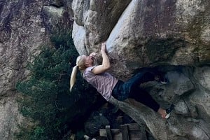


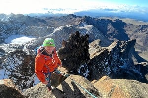

Loading Notifications...