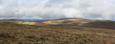
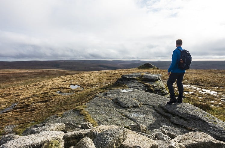
This testing circuit of north Dartmoor takes in three of its four highest summits, a number of more interesting lower tors, and a whole lot of rough, boggy moorland in between. It also visits Cranmere Pool. Before the military built their roads through the Okehampton Range this was considered one of the most remote locations on the moor, and even today it takes some finding. Though no more than a reed-fringed puddle in a bog, Cranmere Pool is notable as the site of the first Dartmoor Letterbox, and you can still sign the visitor's book and stamp a card to prove you made it. Geocaching is no new thing: they've been letterboxing on Dartmoor for 150 years! To add some leafy greenery (and considerable effort) to the round, I've included an approach via the idyllic wooded valley of Belstone Cleave. Anyone looking to go easy on themselves could make things more manageable by starting at Belstone village instead. But if you're going easy then you'll probably want to avoid Cranmere Pool too, and maybe this whole walk... Note: This route is only possible when live firing is not taking place on the Okehampton Range. For scheduled firing times see www.access.mod.uk or call 0800 458 4868
Detailed description

This has been viewed 3,441 times
Download
OS maps and some other mapping apps don't allow waypointsStatistics
Difficulty: SevereDistance: 17.52 miles (28.20 km)
Total ascent: 808m
Time: 8 – 10 hours (Walking)
to rate this walk.
Summits
Belstone Tor 479 mHigher Tor 470 m
Oke Tor 466 m
Steeperton Tor 532 m
Hangingstone Hill 603 m
Dinger Tor 550 m
High Willhays 621 m
Yes Tor 619 m
Additional Information
Start/Finish:Sticklepath village (park considerately), SX643941
Nearest town:
Okehampton
Terrain:
A bit of everything: clear footpaths, bulldozed vehicle tracks, pathless moorland, seas of sucking bog and ankle-twisting tussock grass, and even some tarmac.
Seasonal variations:
The first concern is not the weather, but the ordnance. Most of this walk takes place on the Okehampton Range, so it's only viable when the army are not blowing things up. For scheduled firing times see www.access.mod.uk or call 0800 458 4868 Full winter conditions might be rare this far south, but in snow or a gale this would be an arduous round. One for skiers, in a hard winter?
Public transport:
Local bus to Sticklepath
Maps:
OS Explorer OL28 (1:25,000), OS Explorer 113 (1:25,000), OS Landranger 191 (1:50,000)
Accommodation:
Not a place to stay, but the Devonshire Inn in Sticklepath is an unmissable bit of heritage, if you can catch it on an open day: they don't make pubs like this any more. More typical (decent) pub fare at the Taw River Inn, Sticklepath, and the Tors Inn, Belstone.
Find more Listings near this route
Tourist info:
Okehampton (01837 53020); Chagford (01647 432080); Moretonhampstead (01647 440043)
Further Routes
by Dan Bailey UKH
- East Ridge of Beinn a' Chaorainn and Beinn Teallach 21 Jan
- A' Chralaig and Mullach Fraoch-choire 4 Dec, 2023
- Meall na Teanga & Sron a' Choire Ghairbh - The Loch Lochy Munros 6 Nov, 2023
- Bynack More 19 Oct, 2023
- Beinn a' Mhuinidh 4 Oct, 2023


This is an excellent route in an amazing location. Grew up close to Dartmoor and spent lots of time there.
I was about to say you could extend the route to include Fur Tor which is a wonderful place...but that would add on a few more miles to what is already a long day. One for wild camping probably...
Did this walk on a baking hot day 2 summer's back. Some of the terrain is testing to say the least. Ran out of water halfway round! The northern bits of Dartmoor are so much quieter too.
I was hoping to get in to Fur Tor via Tavy Cleave the other week, but the kids revolted (and it was going to get dark). One for next summer...
Bit ironic running out of water up there, but I struggled too recently. The ground was totally bogging but any running water was brown with peat and tasted like cold stewed tea
Last time I was there we did south to north over two days taking in Ducks Pool and Cranmere Pool. V misty and some hard navigation. Anyway, completed it all in one piece only to fall foul of a dodgy pasty in Okehampton and spent most of night at home in the toilet...