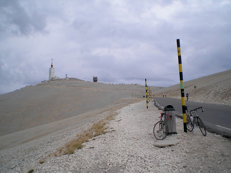
This major tick is a must for any aspiring road biker and this best route of the three routes up Mont Ventoux.
This is one of the giants of the Tour de France and a popular stage for a summit finish. It towers high above everything else in the area and is visible from miles away but also offers great views. The most striking feature of the mountain is the bald summit landscape, a vast expanse of limestone blocks without any vegetation, which make it looked snow-capped all year round. This is apparently the result of deforestation but, whatever the cause, it gives a unique environment to cycle in and makes it one of the most atmospheric climbs in Europe.
The route from Bédoin is a long and steady climb with few respites. The Malauéne route has some steep sections and is actually found harder by some road bikers who prefer a steady climb where they can build up a rhythm, but is not the 'approved' TdeF route. The third way from Sault is considered a slightly 'soft' option although is still a decent challenge but the start is nearly 400m higher than Bédoin.
Detailed description
This has been viewed 4,015 times
Download
OS maps and some other mapping apps don't allow waypointsStatistics
Difficulty: SevereDistance: 13.56 miles (21.82 km)
Total ascent: 1,600m
Steepest Gradient: 13% (1 in 8)
Time: 1:30 – 3:30 hours (Road biking)
to rate this walk.
Additional Information
Start/Finish:Bédoin near Carpentras and Avignon in the South of France, 44.1240, 5.1862
Nearest town:
Bédoin is a small village, Carpentras is bigger.
Terrain:
A steady climb all the way from Bédoin on very good roads which have a cycle lane.
Seasonal variations:
Too hot in the height of summer, and snow-covered in most winters. Spring and Autumn are the time for this one although many still take it on in July and August.
Accommodation:
There are plenty of small hotels and campsites available in the area. Campsites can get busy in the summer months. Buis-les-Baronnies makes a good base to combined biking and climbing.
Find more Listings near this route
Bike Hire:
Very good road bikes can be hired in both Malaucéne and Bédoin.
Further Routes
by Alan James - Rockfax
- Calver, Bramley Wood and Baslow Away from the Crowds 6 Feb, 2023
- Saughy Hill and Usway Burn 7 Jan, 2022
- Rushup Edge - Away from the Crowds 14 Sep, 2021
- Eyam History Family Walk 20 Aug, 2021
- Ladybower Circuit including Win Hill 1 Jul, 2021
- Ughill Moor and Boots Folly - Family Walk 10 May, 2021
- The Scottish border ridge from Upper Coquetdale 24 May, 2020
- Abney Moor - Away from the Crowds in the Peak District 23 May, 2020
- Win Hill Loop 4 Mar, 2013
- Eyam Moor and Bretton Clough - Family Walk 21 Feb, 2012


