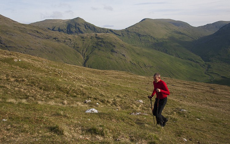
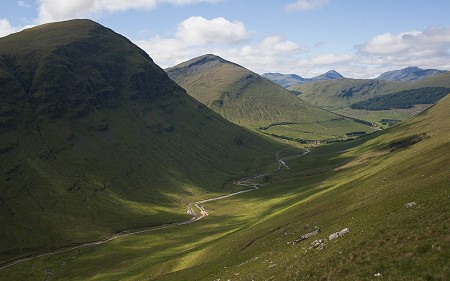
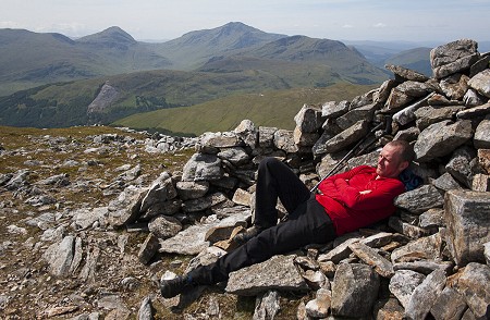
Perhaps the only Corbett grouping that allows so many to be climbed in a sensible single day, the Tyndrum Five makes a rewarding challenge for connoisseurs of the quality walking to be found below the 3000-foot threshold. It’s a well known route, yet far less threadbare than the more heavily used multi-Munro rounds. Paths are faint and crowds unlikely, and this peace is very appealing. Though ringed by higher ranges these hills offer fantastic views, and the best of them have qualities to match many Munros – conical Beinn Odhar with its airy outlook over Tyndrum; Cam Chreag’s knobbly seclusion; and split-sided Beinn a’ Chaisteil, half turfy grazing and half precipitous rampart.
Detailed description
This has been viewed 4,398 times
Download
OS maps and some other mapping apps don't allow waypointsStatistics
Difficulty: SevereDistance: 15.41 miles (24.80 km)
Total ascent: 2,088m
Time: 9 – 10 hours (Walking)
to rate this walk.
Summits
Beinn nam Fuaran 806 mCam Chreag 884 m
Beinn Chaorach 818 m
Beinn Odhar 901 m
Beinn a' Chaisteil 886 m
Additional Information
Start/Finish:Side of A82 by Auch turnoff (limited parking spaces), NN316354
Nearest town:
Tyndrum
Terrain:
Pleasant grassy walking on the tops of the hills, but the flanks are steep and lower ground can be boggy. Paths are sketchy in some places and non existent in others.
Seasonal variations:
The steep descents from Beinn Chaorach and Beinn Odhar need care in winter. The uniformly grassy slopes may be hazardous in avalanche prone conditions. The round would make a fantastic ski tour.
Weather and Hill Conditions: mwis: West Highlands – Met Office: West Highlands
Public transport:
The start of the route is mid way between Bridge of Orchy and Tyndrum, both served by train and bus routes from Glasgow.
Guidebooks:
Great Mountain Days in Scotland (Cicerone) https://www.cicerone.co.uk/great-mountain-days-in-scotland
Maps:
OS Explorer 377 (1:25,000), OS Explorer 378 (1:25,000), OS Landranger 50 (1:50,000) Directory Listings:
Find more Listings near this route Tourist info:
Tyndrum (08452 255 121)
Further Routes
by Dan Bailey UKH
- East Ridge of Beinn a' Chaorainn and Beinn Teallach 21 Jan
- A' Chralaig and Mullach Fraoch-choire 4 Dec, 2023
- Meall na Teanga & Sron a' Choire Ghairbh - The Loch Lochy Munros 6 Nov, 2023
- Bynack More 19 Oct, 2023
- Beinn a' Mhuinidh 4 Oct, 2023


We did it last year, but tackled Beinn a' Chaisteil direct by the broad SW spur and finishing via the N ridge of Beinn Odharhttps://www.ukhillwalking.com/logbook/e.php?d=20190504&u=2022&i=571192
A great day out, met 2 people all day despite it being a sunny bank holiday weekend. Highlight was getting to the top of a knoll and finding a golden eagle feasting on a sheep's corpse a few feet away down the other side.
We did this over a decade ago, when my wife was four months pregnant with our eldest.
It felt quite a big day due to the significant drops between the hills - although she seemed less knackered than I was at the end, so I reckon it must be easiest done when pregnant.
Good advertising Dan. You just sold another copy of Great Mountain Days in Scotland. Looking forward to getting out again sometime : )
Did it a few years ago. Big day, needed chicken curry & chips from the real food cafe to recover.
We started due west of Bein Odhar at the big lay-by. Bit of a slog.
Have also done a variant taking in Beinn Mhanach which was good.
It is a big day - bigger than many Munro outings. They're all on the watershed, so I did them in one go in 1987 with a camping pack - don't think I could do that now. Also (as a day out) once did Tyndrum-Mhanach-Creag Mhor-back over two of the Corbetts - that can't often be done, but was good as I recall.