


© Charles Arthur, May 1998
Government U-Turn has Positive Prospects for Climbers
On the 17th of November Prime Minister Gordon Brown and information tsar Sir Tim Berners-Lee announced a change in tack on map usage rights.
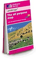
As of April next year the Ordnance Survey (OS) will be allowing free access to map data down to a scale of 1:10,000.
Currently all OS map data is held under copyright which is strictly enforced. The fees for usage are extremely high, pricing many small businesses out of the market and allowing huge organisations like Google to dominate in the online map field.
Speaking to UKClimbing, former UKC editor and current Guardian technology journalist Charles Arthur said:
"It's a really big change, and one that Guardian Technology has been campaigning for since March 2006 under the banner of "Free Our Data", and we're really happy that it's finally happening."
The possibilities for climbers are quite profound, as websites such as UKC will be able to use high detail OS maps to show crag locations which could be integrated in to GPS or mobile phone technology. Although there are many 'free to use' maps already online, opening up OS information will have a big effect on the quality of data available.
Charles Arthur explained:
"Presently, although you see loads of maps online, they all have to be paid for - and they're surprisingly expensive. Which is why only big organisations like Google can afford to present them. They might look free (because you don't think you're paying for them), but actually councils and other organisations have to pay big money. Ordnance Survey, the government-owned body that does all the mapping, gets £117m in revenues from licensing its maps, including online ones (the majority of its money is from digital maps)."
This could also cross over in to the printed medium with maps inside guidebooks potentially using the OS information. There are multiple possibilities.
"Potentially - though this has to be confirmed - you might even get printed 'climbers' maps', done by forward-thinking companies like Rockfax. Maps with the names of crags on, which don't include useless detail you don't need, and only focus on the things you do. (That depends on the precise detail of the copyright licensing, but it seems to follow that you should be able to print a map from the copyright-free online version)."
The Guardian newspaper has been at the forefront of the campaign to free this data, which would bring the UK in line with the USA who have free access to their maps.
However the union representing staff at the Ordnance Survey said the U-Turn was in "complete contradiction with the OS's own plans to explore commercial opportunities and find new ways of raising revenue". Could this potential lack of revenue be damaging to the OS and result in a drop in quality of the UK's mapping services. Charles Arthur thinks not:
"OS argues that it's functioning like a government-owned private company, and that it doesn't get any tax funding from the Treasury - unlike the Home Office or any other government department. But in fact half its income is from government departments - so that doesn't hold water."
Charles Arthur was a major contributor to UKClimbing.com from its early days in the late 1990s up to 2008. I remember discussing the issue of OS data with Charles back in 2002 and since then he has been at the cutting edge of the debate in his capacity as a regular Guardian columnist.
Exact details of the shift in policy are not yet available and it seems there has been a lack of communication between the Government and the OS. Answering a query from the Free Our Data website on how much revenue the OS is likely to lose, the OS said they were “not in a position to make any comment at this time”. The lack of any OS representative at No. 10 when the policy shift was announced was surprising, however there is growing public support for the scheme which is clearly a spanner in the OS's future revenue plans.
Alan James, UKC and Rockfax owner.
In their recent article for the TimesOnline Tim Berners-Lee and Nigel Shadbolt sing the praises of freely available information and actually consider it to be a financially viable long-term option:
"When in 1854 John Snow took the deaths from a cholera outbreak in London and plotted them on a map, he was able to illustrate the connection between the quality of the source of water and cholera — the world changed...
...Openly available public data not only creates economic and social capital, it also creates bottom-up pressure to improve public services. Data is essential in enabling citizens to choose between public service providers. It helps them to compare their local services with services elsewhere. It enables all of us to lobby for improvement. Public data is a public good."
- You can read more about the Free Our Data campaign at www.freeourdata.org.uk


Comments