In this feature from the British Mountain Guides, a qualified and experienced guide chooses us a route up one of the world's most beautiful mountains.
Here Phil Pool takes us to the frozen wastelands of the Arctic on a mission to explore East Greenland.
"As the highest peak in the Arctic, Gunnbjørnsfjeld is often referred to as the "8th summit" amongst those wishing to add to their 7 summits challenge. With only two or three ascents each year this very rarely visited mountain has had only about 60 ascents to date."

- Range: Watkins Range, East Greenland
- Mountain: Gunnbjørnsfjeld 3,693m, the highest mountain in the Arctic
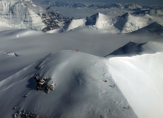
- Route: Southwest ridge.
- Return: Decend route by SW ridge
- Length: 1500m 10 – 15 hours
- Grade: PD
- Guidebook & Map: Getting information and maps can be tricky, but the best information to be found at climbgreenland.com for logistics information, maps and air photographs.
- Valley base: South fork of Woolley Glacier
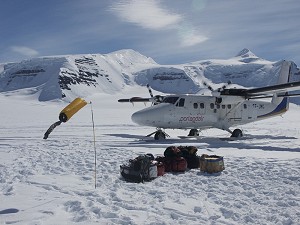
Approach: The remoteness of mountains in East Greenland make approach difficult and this is normally achieved by charter of a Twin Otter ski plane flying from either Constable Point in East Greenland or Ísafjörður in Iceland.

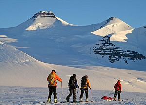
Best tactics for an ascent: There are plenty of delays in Arctic travel with weather and flight delays so 2 – 3 weeks should be put aside UK to UK. The best time of year is late April to early June when the weather can be quite settled and the winter temperatures have risen. Once established at base camp, you have a couple of options. You can go straight for the summit from camp in one long day with 1500m of ascent over 10km. The disadvantage of this, apart from the long day, is that you have no chance for acclimatisation, but it's an option if you are short of time. The other option is to establish a camp in a wonderful little glacial bowl at C. 2850m using pulk sledges. This make good acclimatisation, cuts the summit day time considerably and puts you in a good position for other mountains in the area. You are also closer to your shelter; help is a long way away. Polar bears are rare, but one did attack the base camp on the 2006 1st winter ascent.
Descent: You go down the way you came, but you have to careful on the steep bit if the snow conditions are bad. Gunnbjørnsfjeld has only had a handful of ski descents from the summit, but once back at the col the ski-ing back to camp can range from wonderful powder to rock hard sastrugi, usually a mixture of both.
What makes it so special: The remoteness of Gunnbjørnsfjeld meant that it was not climbed until 1935 with only two other ascents up until 1988. The Watkins range contains all of the 10 highest mountains in the Arctic and many parties continue to climb Dome and Cone the 2nd and 3rd highest mountains. You are very unlikely to meet anyone else out there and there are still unclimbed summits awaiting first ascents.

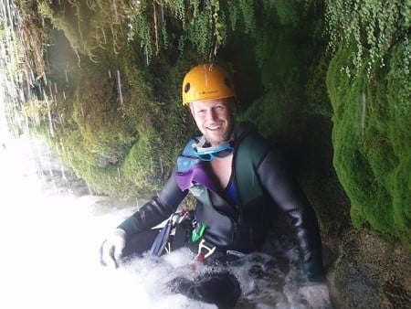
After 15 years guiding ski touring and mountaineering in the Alps and two seasons in Antarctica, Phil now specialises in Polar expeditions to Greenland. When not in the Arctic, he runs canyoning trips to France, ice climbing courses in Norway and Lake District rock climbing.
- For more information go to Philippoole.co.uk


Comments