Climbs 40
Rocktype Sandstone (hard)
Altitude 300m a.s.l
Faces NW
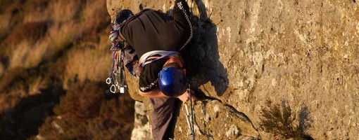
Just one more bit of gear © JDal
Crag features
A smallish crag in the MOD Otturburn Ranges. The majority of routes are HVS - E4 and the crag is an excellent spot for those operating in that sort of range.
Approach notes
Because the crag is on the MOD ranges permission for access should be obtained by phoning 0191 2611046, unless the red flags are down. This is an area of the range used for small arms stuff and you can very often get access even if the flags are flying.Follow the MOD road out of Holystone and on entering the danger area turn left. After 2km the crag becomes visible.
Restricted Access
This crag is on a live firing range and therefore subject to military bylaws. DO NOT PICK UP, KICK OR REMOVE ANY OBJECT FROM THE OTTERBURN TRAINING AREA, IT COULD KILL.
Seasonal Restrictions
Reason: Nesting Birds
-
You or one of your party must have attended a Range Safety Briefing in the last year and have a parking display sheet.
-
Check the firing status: https://www.gov.uk/.../publications/otterburn-firing-times.
-
Call Range Control: 01830 520569, provide details/timings etc and get their approval. (Or not). Even if there is firing, it’s worth calling the Range Control Office as the firing may not affect the location you want to visit.
-
Call Range Control when you and your party/group depart.
-
Do not lift and go through any barrier that is down. That means the road is closed. (They are left unlocked so emergency vehicles can get through.
Do not touch anything..
| There are no comments from visitors to this crag. |
Climbs at this crag
| Name | Grade | Stars | Type | Logs | Partner Ascents |
|---|
These climbs you have climbed by seconding or top-roping.
These climbs you have Dogged.
These climbs you Did not Finish.
Climbs are waiting to be checked by a crag moderator, and may not be accurate. Climbs can't be verified by a crag moderator, and they need more information to confirm it. Climbs are no longer climbable.
Moderators Updates to this page are checked by UKC volunteers Franco Cookson and Jon Tweedlie