


Research carried out by prolific hill surveyor Alan Dawson, owner of the Grahams hill list, suggests that Ordnance Survey maps - and the hundreds of guidebooks and websites that rely on them - list the wrong summit height for 'over half' the mountains in Britain.
Using satellite technology, he measured the height of over two thousand summits in a ten-year programme of landscape surveying, to obtain more accurate figures.

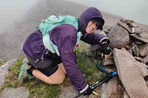
© Alan Dawson
"Analysis has shown that over half of the summit heights on current maps are wrong" he says, "though not by much."
As an example, Alan points to the latest edition of The Munros guidebook published by the Scottish Mountaineering Trust, which lists 508 summits over 3000 feet high. Having surveyed 432 of these to date using GNSS (Global Navigation Satellite System) data, he says that 58% of the published heights are wrong by one metre or more, though 97% are correct to within three metres.
The reason for the discrepancy is the methodology used by Ordnance Survey. To obtain most mountain heights the OS uses aerial surveys, with figures then rounded to the nearest metre.
"This method is effective for OS purposes as it allows maps of the whole country to be produced in an efficient way" says Alan.

© Alan Dawson
"Satellite-based surveying is more labour intensive, as it requires carrying heavy survey equipment to the top of each summit and waiting there to record satellite data. However, it is forty to fifty times more accurate for obtaining heights of summits or any specific points of interest. Aerial surveys give heights that are accurate to within three metres, compared to six centimetres for GNSS surveying."
Most spot heights on Ordnance Survey maps may be derived from aerial photography and photogrammetry, but heights of triangulation points are derived from ground-based surveys, and so can be considered accurate to within one metre.
Rocky summits can be measured more accurately than vegetated tops, says Alan, and the biggest challenge for hill surveying is not the weather or the technology but the large cairns on top of numerous hills - some historic, others built by more recent walkers.
"These may obscure the highest point and can interfere with satellite signals" says Alan "so they limit the level of accuracy that can be obtained."
Smaller cairns can be removed or replaced, he says. Large cairns may be the cause of some map heights being wrong, he speculates, because it can be difficult to distinguish cairns from rocks with aerial photography.
"For example" says Alan "the OS height of Gulvain in the Western Highlands is 987m, but the base of the huge summit cairn is only 983.2m. It is not unusual for older OS maps to show more accurate heights than recent maps, as heights on older maps were derived from ground surveys."

© Dan Bailey
In explanation, an OS spokesperson told us:
"Our surveyors have been mapping Great Britain for hundreds of years. As Britain's national mapping service, we are responsible for creating, maintaining and updating the National Geographic Database which contains half a billion features and sees 20,000 daily changes.
"Advances in modern technology have allowed for more accurate height measurement but it is not possible to re-survey all mountains. We use a mix of height databases to source heights and discrepancies in these databases have led to some heights being slightly different between map scales. We are working towards rationalising the different height databases to avoid these discrepancies occurring. It is also important to recognise that heights which appear on OS mapping have been rounded to the nearest metre.
"A good example is Ben Nevis which was re-surveyed in 2016. Using modern technology, which is more accurate than when it was last surveyed in 1949, the measured height has only changed by centimetres, but those centimetres mean we now need to round up rather than down. So the height was updated from 1,344m to 1,345m.
"Where evidence of an appropriate quality survey is provided, we accept data from third party surveyors so that we can update our mapping and the National Geographic Database."
It's not always just a case of a few centimetres
The largest height error Alan Dawson has found on an OS map is 34 metres for the summit of Ceum na h-Aon-choise, a top on the west ridge of Beinn Fhada in Kintail.
"[This] is shown as 891m but the actual height is 924.9m. This peak was not listed by Hugh Munro as he could not have known that it is over 3000 feet high."
The OS map figure was due to cartographic error, he thinks. It's worth noting that Harvey have it at 925m.
"For most purposes, OS maps are superbly useful and accurate" Alan concedes.
"However, numerous hills have different heights on different scales and editions of OS maps, as they have different sources. OS are now trying to make their maps more consistent, though that does not necessarily mean more accurate."
- Initial analysis of survey results from lower hills has shown that about half of summit heights are wrong, says Alan, but precise comparison between maps and survey results is difficult, because many summits have different heights on different scales of map, and some hills have no height shown at either 1:25000 or 1:50000 scale.
- Alan's survey reports are gradually being added to his Pedantic website, so anyone interested or sceptical can check the consistency of height figures obtained with reference to various OS Net base stations, as well as the duration of data collection and other relevant information. Details are added to the authoritative Database of British and Irish Hills as the reports are published.


Comments
My question on this is, given there appears to be a universal appetite to produce accurate and consistent mapping, will the survey results be fed into to OS? This being as they are the most widely used maps by hill-goers.
That'll be erosion then.
the answer is in the article...
"Where evidence of an appropriate quality survey is provided, we accept data from third party surveyors so that we can update our mapping and the National Geographic Database."
That certainly shows willing from OS.
I guess the difficulty there is knowing the veracity of any new data being fed into the OS. I mean if one well meaning amateur says a hill is 451m and another says its 443, what do you do ? Do you replete the contours near 450m or not ?
Personally I'd prefer OS resources were used to get cycle paths properly mapped!