


The UKHillwalking route cards system has gone live. It's been months in production - but we hope you agree it's been worth the wait.
- Give free rein to your inner guidebook author; create your own routes to be in with a chance to win an Exped Dry Bag Pro 25l rucksack.
- Search the system via zoomable map, activity, area or name on our user-friendly Find Route Cards page.

Although only in its early stages, the selection of walks, runs and bike rides already includes some must-do classics, personal favourites, obscure gems and organised events. There should be something for everyone, ranging from multi-summit epics like the 30km Ennerdale Skyline Circuit and hill races like the utterly bonkers Montane Lakeland 100 ultramarathon, to gentle family-favourites such as Mam Tor in the Peak.

We've got classic scrambles like An Teallach and the Snowdon Horseshoe; backpacking trips including the Rhinogau traverse and Knoydart's Sgurr na Ciche; and gentle strolls as easy as Ben Vrackie. Have a look at our road runs, trail runs and fell runs like this short run in the Hope Valley; or saddle up for a road bike route like the classic Galibier or the monsterous Mont Ventoux.
Each route card features detailed step-by-step route descriptions with stages corresponding to numbered waypoints on the map; attractive photos; zoomable maps; at-a-glance ratings for difficulty and quality; listings for accommodation, public transport and appropriate paper maps and guidebooks. Route descriptions and maps can also be printed out.
It's a work in progress but over time we will build up comprehensive coverage of every racing event and every worthwhile hill in all the major hillwalking areas of the UK - and beyond.
To get us started we got Dan Bailey, UKH Editor, to upload some of his favourite walks. The result is a pretty impressive collection - check them out here - from all over Scotland, the Lakes and Wales.

|

|
Write Your Own Route Cards
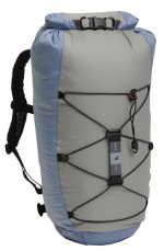
Win a Dry Bag Pro 25ltr Rucksac
As an incentive we are offering 40 prizes of Exped Dry Pro 25ltr Rucksacs for the best 40 route cards submitted by 1 December as decided by UKH Editor Dan Bailey. To be considered for this prize the Route Card must be submitted including all the data and use the Way Point system to describe the route. You will be allowed to resubmit if there is a problem initially.
Our route cards are an open system, combining routes made by the UKH team with content submitted by users, from keen individuals to event organisers. If we haven't yet added your favourite walks, runs and biking routes then why not have a go yourself? It's easy to create your own on our template page, with scope to wax as lyrical as you fancy and to make your descriptions as detailed as you like.
What to Add - The idea is to describe interesting and complete walks, runs and rides for others to enjoy. Be inspiring, be original and express yourself. Try and avoid adding micro-variations for existing route cards, but design route cards that can be used to base people's activities on with the possibilities for variations, extensions and combinations mentioned if not actually covered.


Comments