
For a year we were planning and organising this expedition – We worked out what has been climbed and what hasn't, decided which map to believe, applied for funding, worked out how to get to the mountains, applied for border permits, assembled medical and toolkits, (tried to) learn Russian (у меня болитживот!), the list goes on... We booked our flights in April, with very poor timing, as only 2 days later we were watching the country become engulfed in riots and revolution on the BBC news. President Bakiyev stole the country's money and fled to his parent's house as protesters battered their way into his palace.
Fortunately, the political situation calmed down and we finally departed Edinburgh on 21st July bound for Bishkek, the capital of Kyrgyzstan. Here we had a couple of days to buy food supplies in the shops and bazaars of Bishkek. After an amusing (in hindsight) incident in which we were taken to a police station and searched, we departed for the mountains. The next day, we reached the army checkpoint controlling entry to the area of Kyrgyzstan that borders China. Our border permit and passports were presented to the soldiers, along with some vodka and cigarettes, and we were through. We rounded a corner and the Torugart-Too mountains came into sight. A year-long journey was almost over.
But we were not quite there yet. A day of off-road driving was required to reach our planned base camp, and this was to prove problematic. We stopped at a Yurt, where our trusty driver (Hassan) asked for directions. He returned with one of the nomads, and some old coke bottles containing an off-white liquid. This was the moment that we had all been dreading, for we knew what it was. It was Koumys, fermented mare's milk. It is Kyrgyzstan's national drink and we could see that politeness was about to dictate that we drank it.
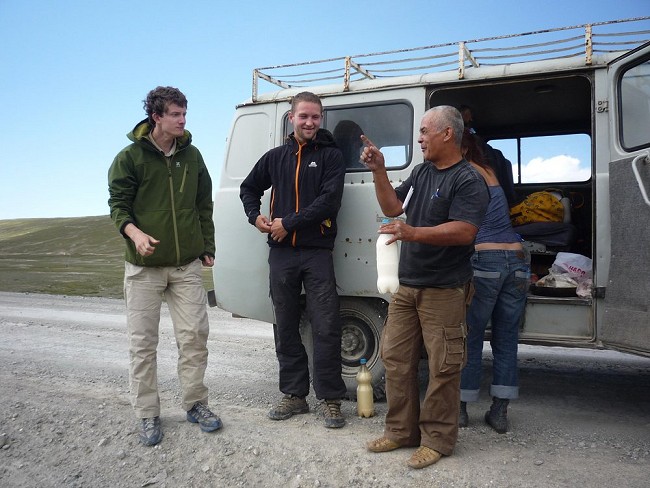
We drove away from the road towards the river Mustyr. To get to our planned base camp site we needed to cross the river, and on seeing the river Hassan was adamant that our vehicle wouldn't be able to make it. Maybe this was the reason why the previous expeditions to the Torugart-Too had visited later in the summer? The next day we hired horses from the local nomads, and with their help crossed the swollen river on horseback to reach our base camp. Hassan guarded the vehicle and we took it in turns to guard the basecamp.
Help from the local nomads was needed to cross this river on horseback and reach our basecamp. Video copyright © Robert Taylor.
We made 3 first ascents. To begin, Robert and myself climbed the snowy peak at the top of the unnamed glacier to the east of Mustyr. We had hoped to get a good look at this and the eastern side of Mustyr itself during our acclimatisation walks, but they had remained shrouded in cloud. While we walked in during the afternoon, cloud again covered the peaks, but not before it had turned the glacier to slush. On one occasion I disappeared almost to my waist in slush. We had planned to pitch our Argos bivvy tent on the glacier, but clearly this wasn't going to happen. So instead we moved to the rocky moraine besides the glacier. Robert got out his bivvy bag and I used the tent fabric as a bivvy bag. It was not a comfortable night, my makeshift bivvy bag pressed against my face under the weight of fresh snow and the only sleep I managed to get was the 10 minutes during which my alarm went off unnoticed.
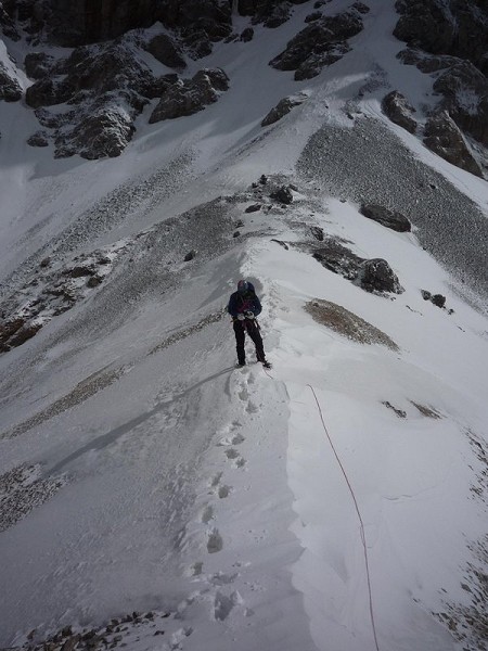
We emerged onto the ridge at a partial clearing of the clouds and stared across into China. The ridge forms the border between Kyrgyzstan and China, and we set off along this snow arête, one foot in Kyrgyzstan and one foot in China. The snowy sections were pleasant and spectacular, but the rock was like weetabix and a section of easy-angled but thin and brittle ice also proved time consuming. To make matters worse it was now apparent that we had taken the wrong couloir in the mist that morning, making the ridge traverse even longer. We emerged onto the subsidiary summit rather too late for comfort and looked down the north-west face. We could see that the séracs were not quite such an obstacle after all. At the eastern end of the face there was plenty of room to climb to the left of the séracs. It was frustrating to learn that our lengthy ridge traverse had been unnecessary, but also a relief that we did not have to do it again on our descent.
We continued towards the main summit. It was marked as 5008m on the Russian military map (our GPS later read 5035m on the summit) and the altitude was making itself felt. The higher we got, the slower we walked. But nevertheless, the summit was eventually reached. My main feeling was one of disbelief that we had actually made it. The clouds had mostly cleared and in the north the glacier wound its way down to the river Mustyr while in the south the rolling brown hills of China stretched away towards Kashgar. Here we were truly at the back of beyond...
We have decided to name the peak “Mur Samir”. “Mur”, according to the local nomads, is a Kyrgyz word for Marmot (the range is overrun by Marmots), and the full name is also a reference to the mountain “Mir Samir” in Afghanistan that was made famous by Eric Newby's classic book “A short walk in the Hindu Kush”.
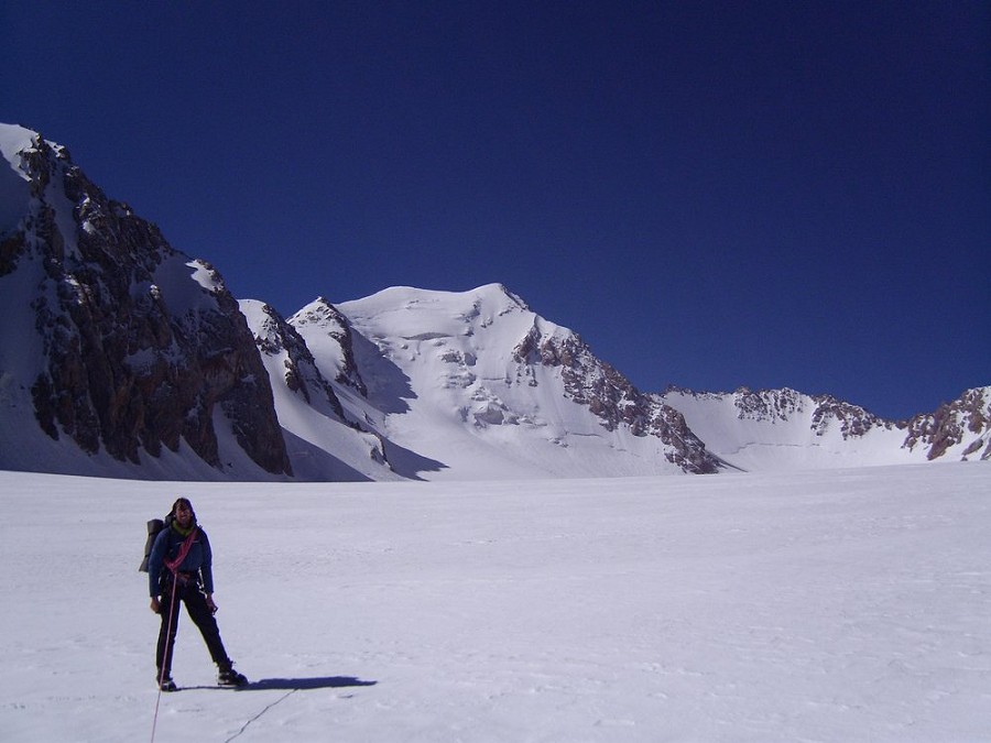
Next, Adam and Robert climbed an unclimbed peak at the northern end of the Mustyr ridge whilst I guarded our base camp. Their route took a snow couloir on the eastern side to a col north of the peak, then followed the snow / ice ridge to the summit. Robert takes up the story:
“Adam and I walked in the day after an exhausted John and I walked out. We pitched the trusty Argos tent at the foot of the North face and watched that evening as rock and ice crashed down our planned line. Adam reconnoitred a snow couloir to the Southeast of the mountain and we decided to head up this in the morning. A restful night on the moraine meant we slept better than we should have.
After a later than ideal start we geared up at the bottom of the couloir, a shooting gallery of bad rock, loose boulders and channels where material was clearly wont to tumble down the face. We moved together up this bowling alley feeling like so many skittles. Our tactics took on a 'capture the castle' quality, charging from one sheltering boulder or wall to another, dodging the salvos of unseen defenders and having the occasional missile clatter on our helmets. Every so often a cannonball sized lump would hurtle past too close for comfort trailed by a slide of slush.
Finally we reached the col via the side of a threatening cornice that looked ready to sweep down the couloir at any point. Here we were on the ridge leading South to Mustyr. Adam and I made an attempt to climb to the North to reach our objective but after a few pitons were hammered into bad rock gave up, the climbing consisting of scrabbling over a thin coat of ice and snow resting on steep scree. Instead we fixed our sights on the peak to the South, an attractive goal with a clear line winding it's way up a shield of ice and rock to the summit....
After some inspired leading by Adam through a surreal dreamscape of towers, flumes and crenellations we reached the summit. Our GPS announced an altitude of 4836m, marginally higher than the peak we had set out to climb in the first place! A successful day out was completed by some strenuous downclimbing to the col and an all out race to the bottom - us against the torrent of rock and ice that was tumbling round about us, the mountain throwing everything after these fleeing raiders. We stayed one jump ahead by running backwards down the slope, plunging our axes like swords into the mountain's wet side. We reached our gearing up place at the bottom soaked and sweating in the heat as everything seemed to thaw and melt around us. Our walkout was enlivened by the agitated state of the glacial streams and our own high spirits.”
Karyshkyr is Kyrgyz for Wolf, this name was chosen for the peak due to the fact that the local nomads have been having problems with wolves recently. During one night, we could hear them and we had to take precautions at our base camp.
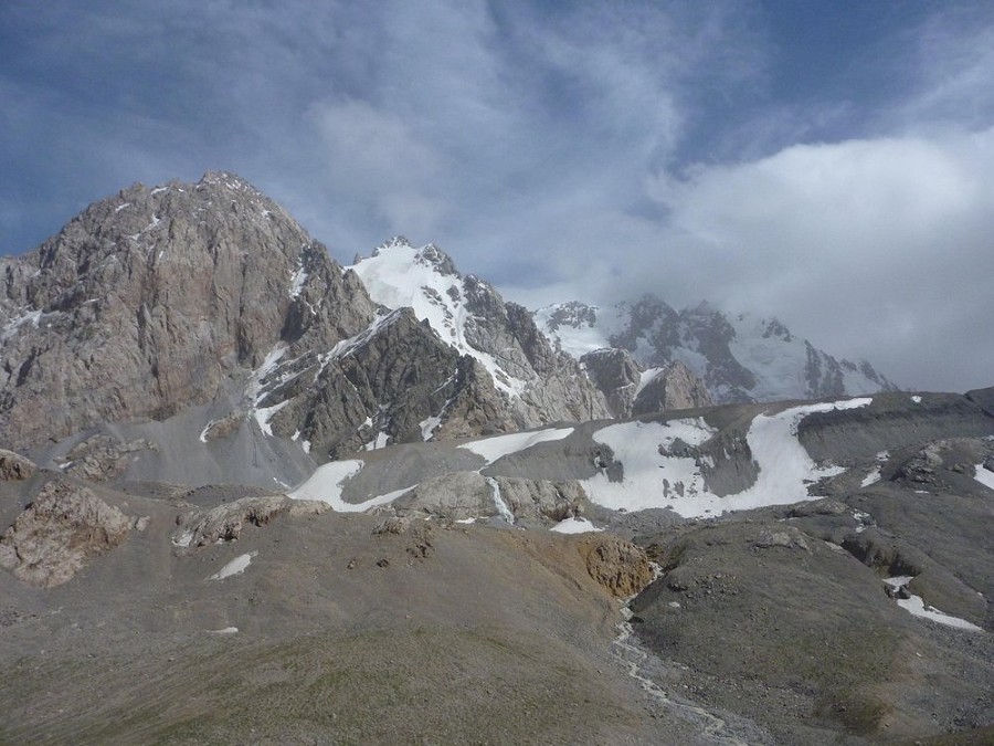
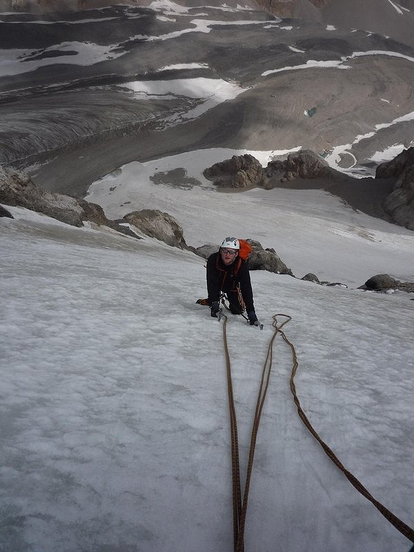
Finally, Adam and myself decided to return to the glacier that leads up to Mur Samir, with the aim of climbing the peak next to it that looked a bit like the Tour Ronde. The river had risen significantly and the crossing to get to the glacier (bad enough first time round) was definitely not on now. So we changed our plans, and headed instead up the Teke-Lutor glacier to the west of the range. We had only taken gear for an easy snow / ice route, so our options on this glacier were limited. We opted to try the unclimbed peak on the eastern side of the glacier. After overcoming the logistical problems caused by forgetting the cutlery, we settled down for the night in the Argos bivvy tent. We set off up the route the next morning, mainly moving together with a couple of ice screws between us. The climbing was not difficult, but at 550m the route was longer than it had looked, with long sections of ice rather than snow, and it wasn't until quite late that we arrived on what had appeared from the glacier below to be the summit. But unfortunately, we could now see that it wasn't the summit. We were on a subsidiary summit, and a ridge traverse for which we lacked the time or gear protected the virginity of the true summit. The summit on which we stood was only slightly lower than the true summit, but it definitely was lower - there was no getting away from it. Our GPS read 4801m. We finished the day with a character-building descent, during which Adam utilised his fast Abalakov-making skills many times, and arrived back at the tent on the glacier at about 11pm.
We finished the expedition with some bouldering at base camp and an ill-advised drinking session with the local nomads before heading back to Bishkek.
In Bishkek we had a good day of sightseeing, during which we visited the places we recognised from the BBC coverage of the revolution back in April – Ala-Too Square, the Presidential Palace, Tsum Department Store and State Historical Museum. The State Historical Museum was well worth the visit. Half of it is devoted to the Soviet era of Kyrgyzstan's history, and features room-sized bronze sculptures of Lenin, Marx and Engels with the proletariat, Lenin's letters, and cuttings from Pravda. There is also an enormous statue of Lenin behind the museum, which I had been looking forward to seeing for many months...
- This expedition has been discussed in the UKC Forums
- You can read the Expedition Blog
We would like to thank our sponsors: The Mountaineering Council of Scotland - MCofS



Comments